With the cool weather coming, I figured I’d get in one more State High Pointing trip in before summer is officially over. High pointing or peaking is hitting the highest natural peaks in all 50 states. Normally, I do my crazier adventures alone because no one is able to take off the time from work or they do not want to do the things that I am planning. This time, I had someone willing and able to make the road trip with me. My friend Bryan started training with me and the plans began. I didn’t know how car camping would work with my Kia Soul and another person, but we were going to make it happen.
Friday, Sept. 4th: I waited for Bryan to get off of work and then I drove the get him and pack up the Kia. We finally got on the road about 8PM.
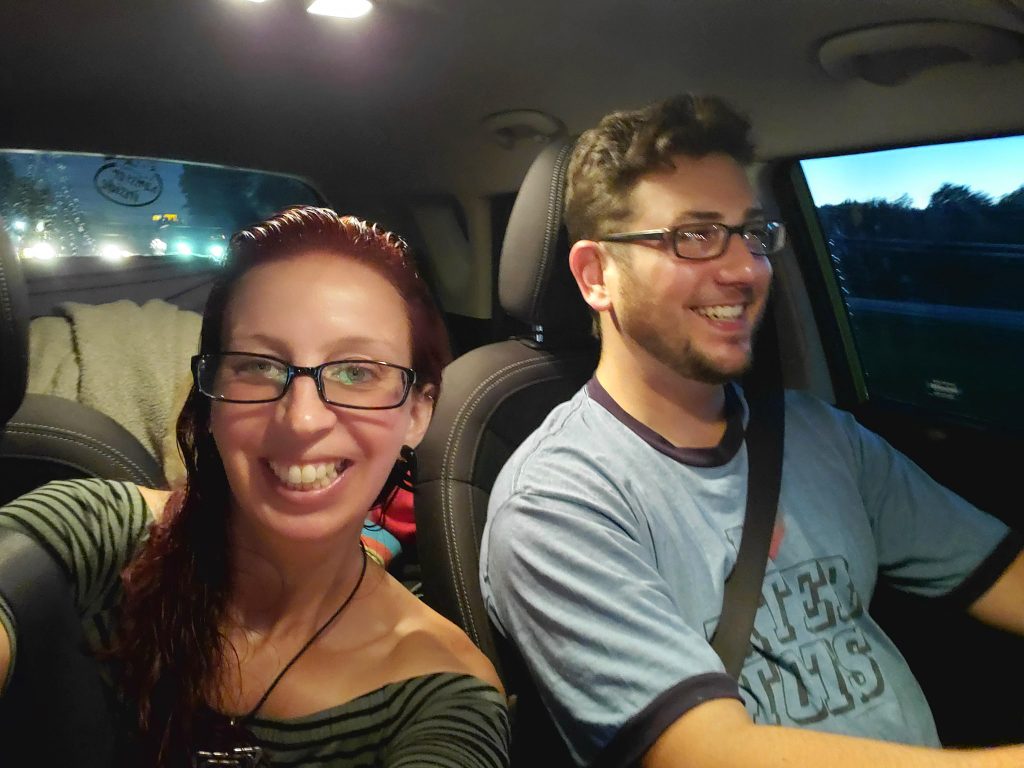
He drove us into PA and we slept at a Loves Truck stop. We couldn’t find any places to camp. I set up my car hammock set-up and he slept in the driver’s side front seat. It was tight, but worked OK. I woke up with the sun…I didn’t want too. I started the trip, the day before, on 3 hours of sleep, so I think my 2 day total was up to 6. I was feeling rough.
Saturday, Sept. 5th: Bryan was the one driving again because of my major sleep deprivation. It was a good thing that we only had Delaware’s high peak planned for the day. We ate egg McMuffins at the truck stop McDonalds then left. We had about 2 and a half hours before we would get to Ebright Azimuth, Delaware’s “High” Peak around 10:30AM. Sorry, Delaware, but that was a lame high peak. Haha! There was no hiking or climbing to this one. Just a drive up to a sign in suburbia. The “view” was a family playing in their front yard.
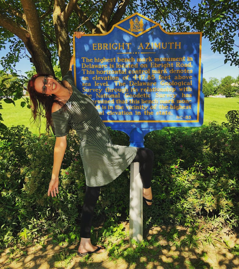
#1 for Bryan
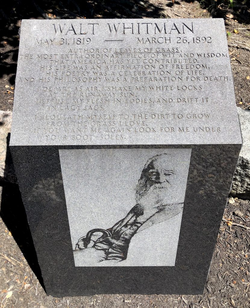
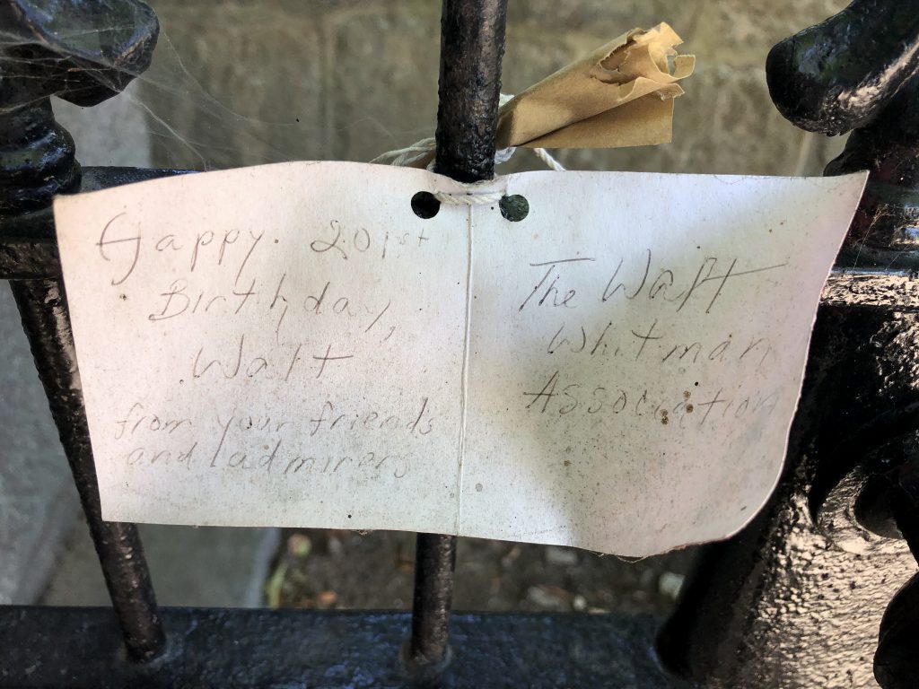
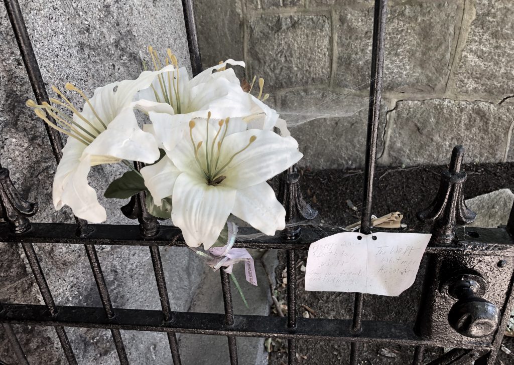
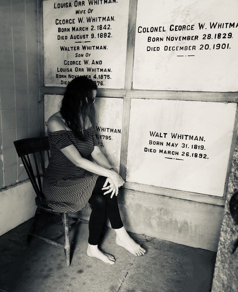
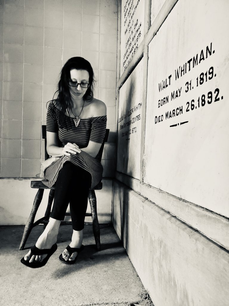
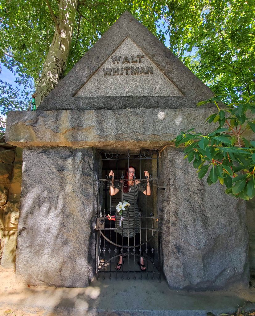
We took a few photos and then by noon we were already visiting Walt Whitman’s crypt in Harleigh Cemetery in Camden, NJ. A pretty stop.
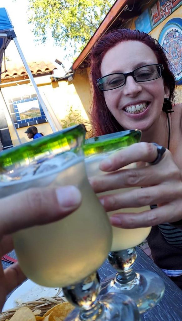
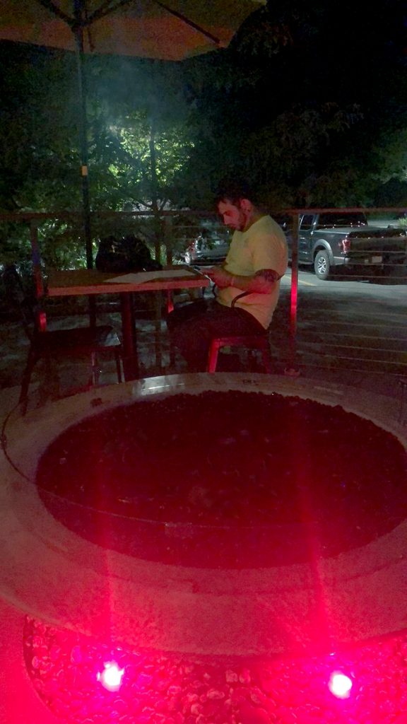
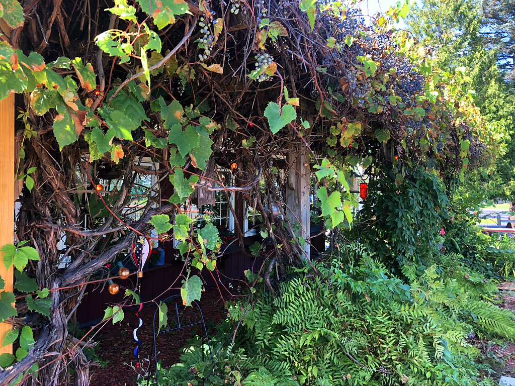
After visiting Walt, we drove a little under 3 hours away to El Bandido Mexican Restaurant to get really yummy food and a pitcher of Margaritas. The guacamole enchilada was super amazing and different than what you would find in typical Mexican places.
Sunday, Sept. 6th: I found a place to camp on Labor Day Weekend!!!! ![]() I had to call a million places while Bryan drove, but I found such a pretty place in Montgomery, NY called Winding Hills Park! It was just under an hour to the New Jersey high point from our home for the night. A guy came by and asked if we wanted fire wood, so Bryan got some. For being Labor Day weekend, it sure was a nice quiet night. It was a bit chilly. I woke up at 6:15 freezing and having to pee! I think I fell asleep at midnight-ish which is so unusual for me. I think I need to be in the dark woods to sleep well.
I had to call a million places while Bryan drove, but I found such a pretty place in Montgomery, NY called Winding Hills Park! It was just under an hour to the New Jersey high point from our home for the night. A guy came by and asked if we wanted fire wood, so Bryan got some. For being Labor Day weekend, it sure was a nice quiet night. It was a bit chilly. I woke up at 6:15 freezing and having to pee! I think I fell asleep at midnight-ish which is so unusual for me. I think I need to be in the dark woods to sleep well.
We were going to attempt 2 high peak hikes this day (NJ and CT) and it would have been doable with getting up so early, but it took time to shower and take down Bryan’s tent set-up, etc. Also, traveling with another person takes more time, I found. Ha! Bryan didn’t know how serious I was about getting up, packing and leaving right away.
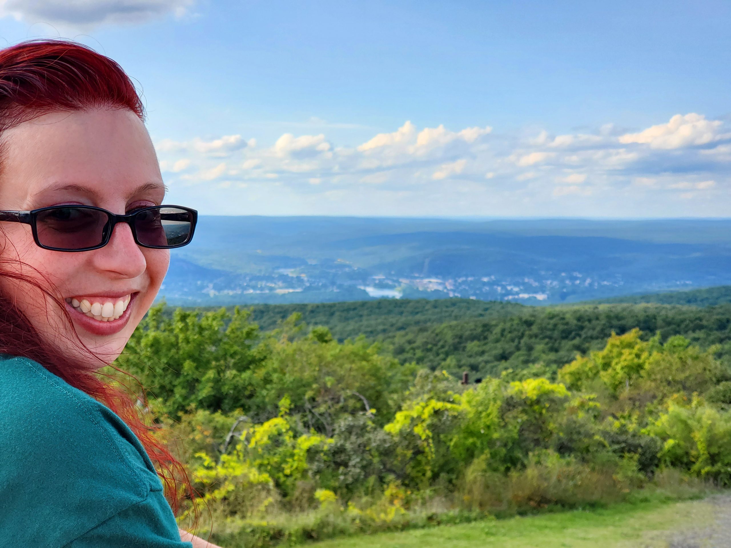
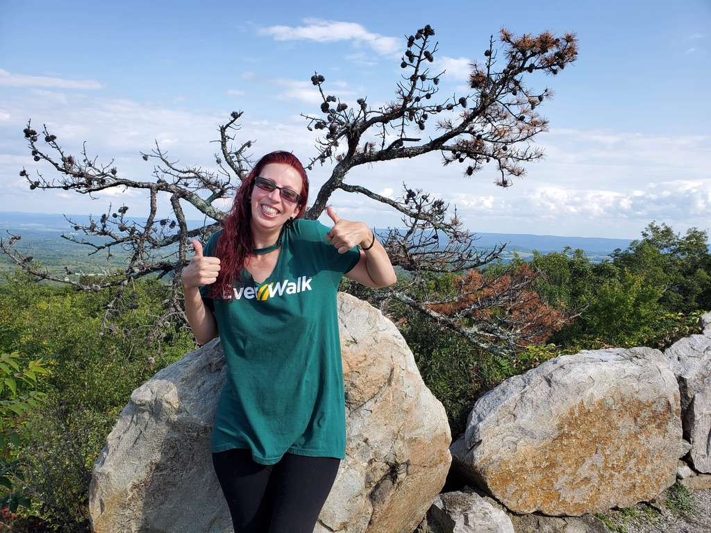
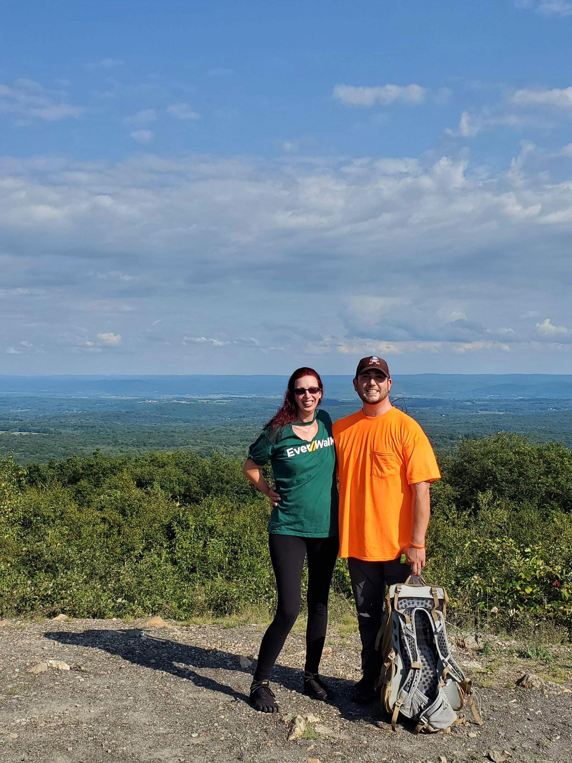
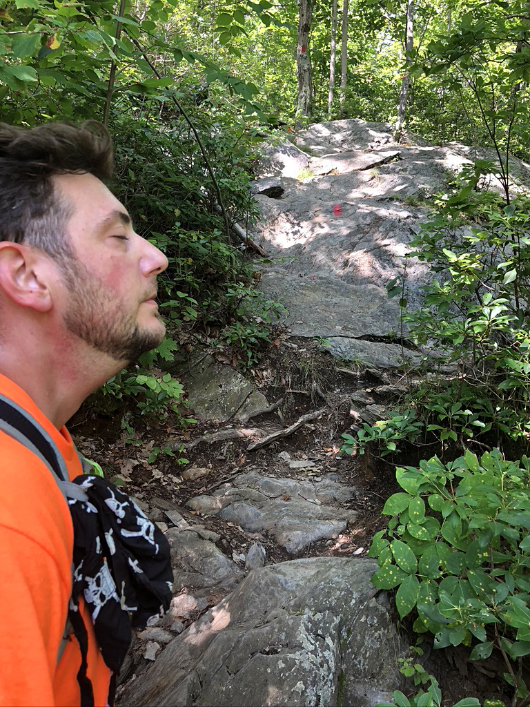
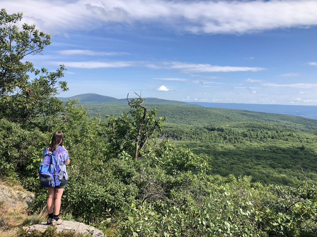
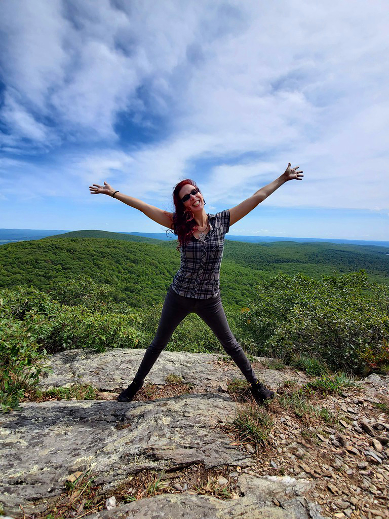
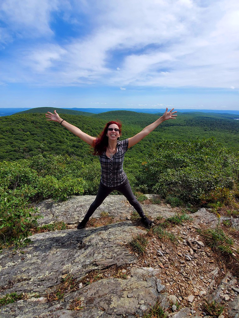
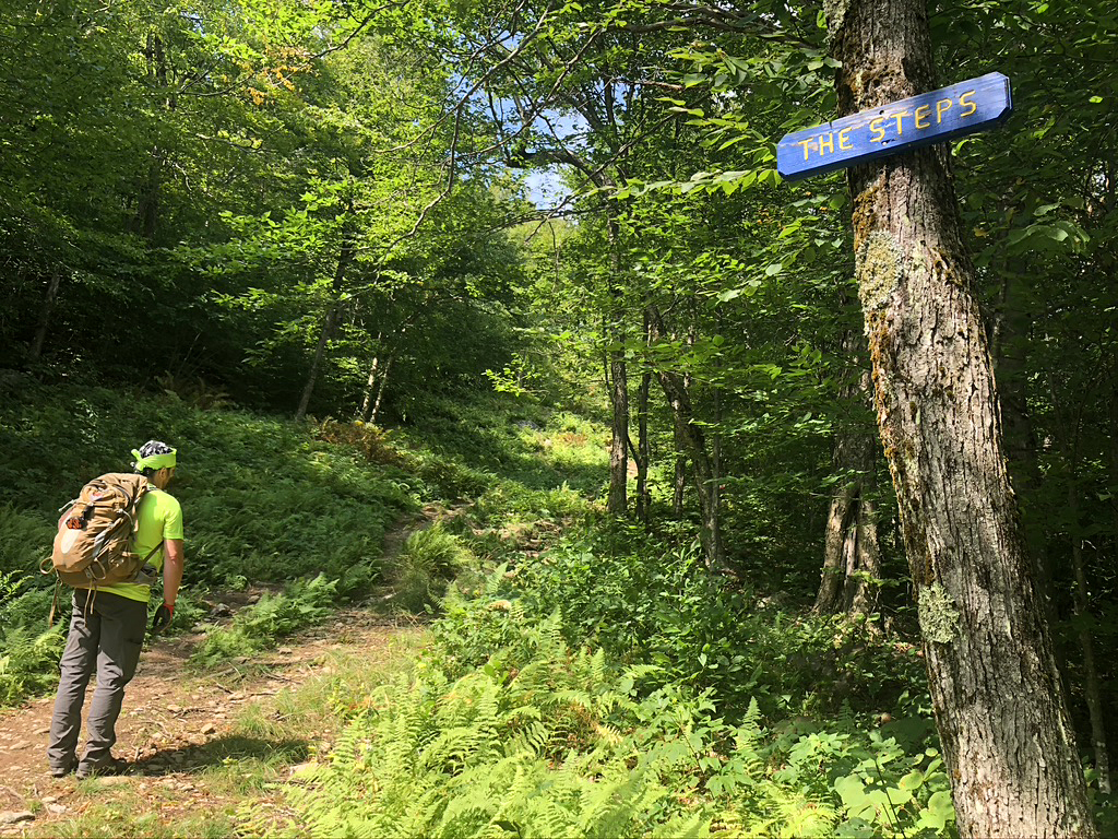
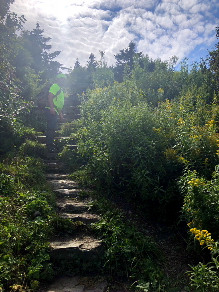
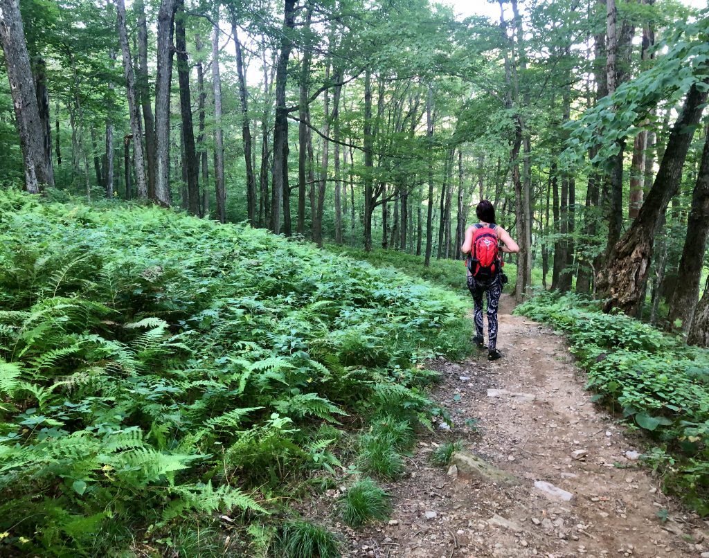
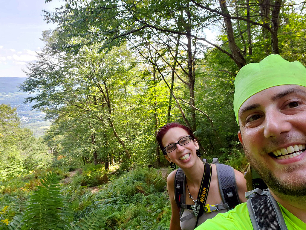
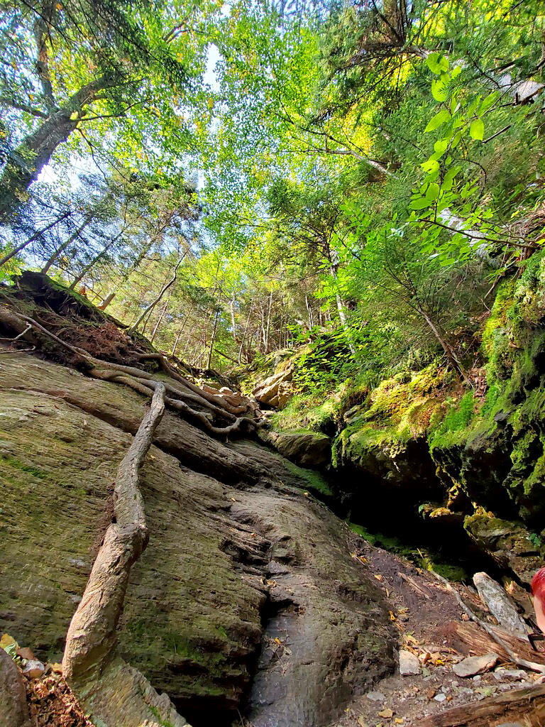
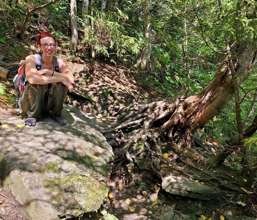
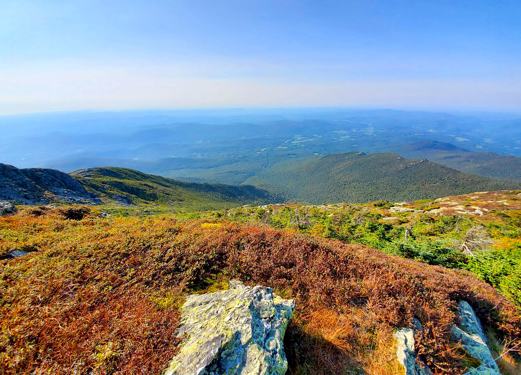
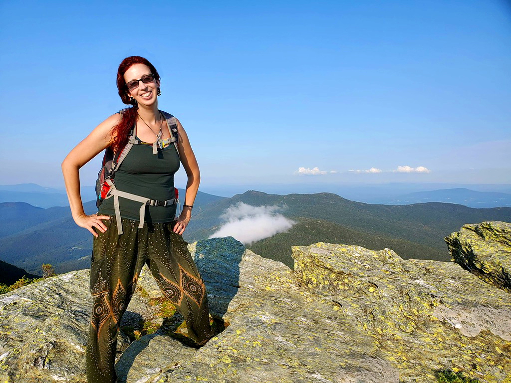
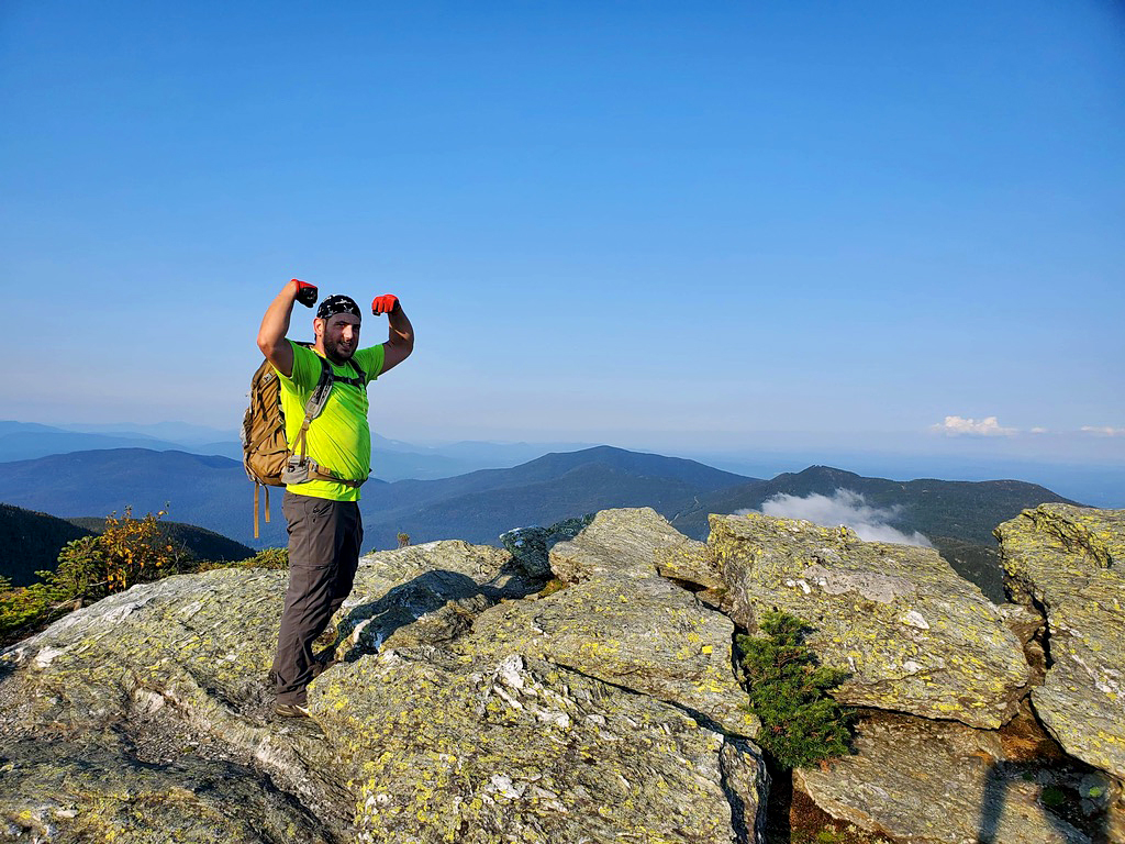
Breakfast took forever to find too, so it became apparent that we would not make it a 2 high point day. We found some yummy spicy vegan taco food at Good Vibes Cafe in Port Jarvis, NY and then headed to High Point State Park where the high peak of NJ was. We had a great sweaty hike up the rocky Monument Trail where it then opened up to a beautiful view of what seemed like the entire state. There is a tall monument that sits on the spot that marks the highest point in New Jersey. It took about 2 hours and ended up being 4.7 miles instead of the 3.5 miles mentioned on the All Trails app. However, we did walk around at the summit a bit. I thought it was strange that there was no sign-in journal, like the other high points I’ve been too. Bryan’s first mountain climb! Awww!
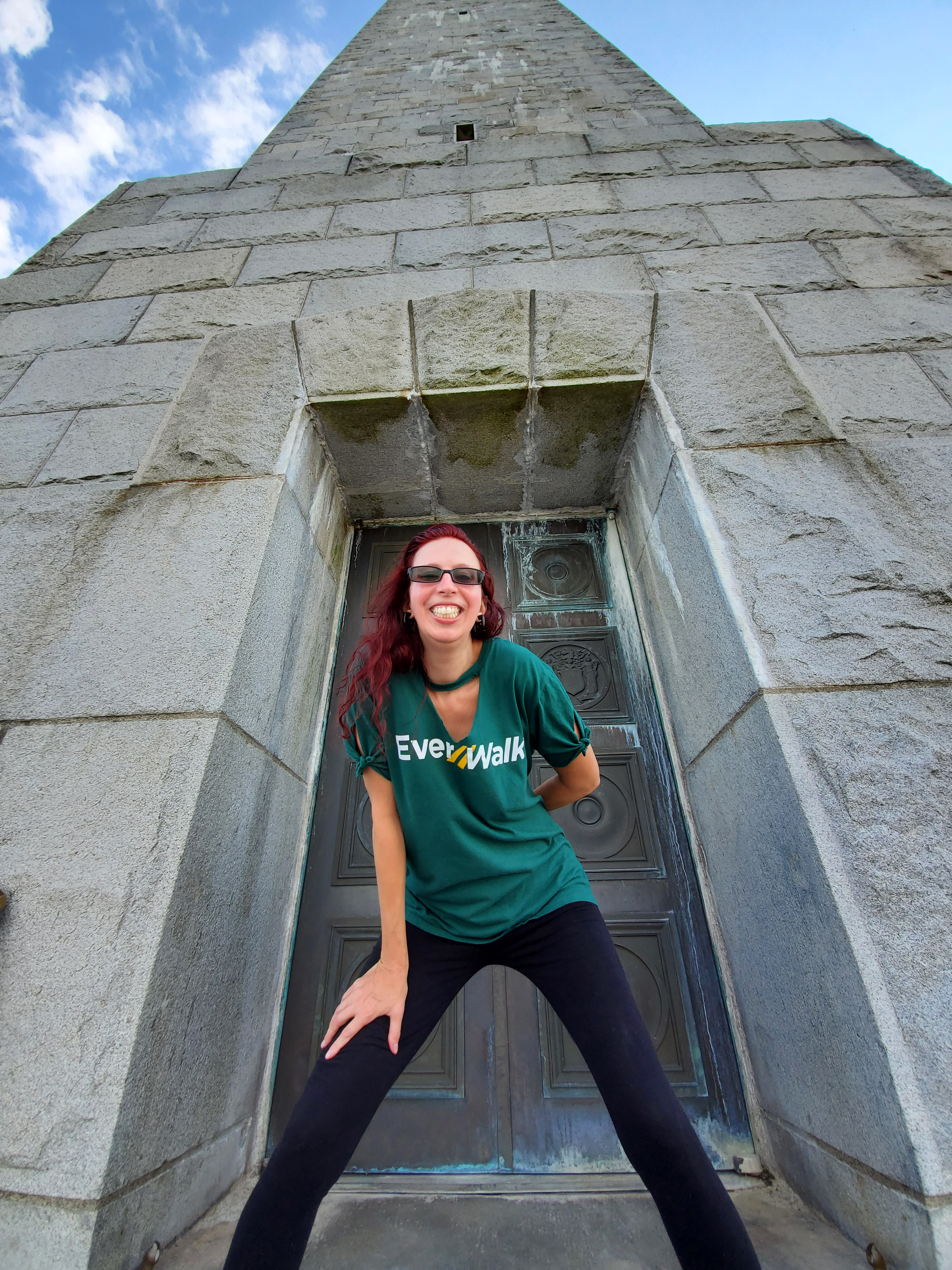
New Jersey’s high peak was not terribly strenuous, but I had them planned the easiest to hardest so we could get our bodies ready for the 15 miles needed for the New York high peak at the end of the trip. Yes, one can drive to this peak, but I vowed to hike / climb to every state high peak I make it to. It makes it more real. It makes it more impressive. How can someone say they made it to all the highest peaks if it’s their car that actually took them there? Thankfully, many are not drive-able.
Look at that view!
Once we were back at the car, we then drove a couple of hours and had dinner at Four Brothers Pizza in Hillsdale, NY for some much needed carbs
and then found a Pilot Truck Stop to sleep at. We couldn’t find a place to camp which sucks as far as showering the sweat off, but we made due. It’s harder for me to sleep with Bryan in the car because of the snoring, also, so I knew climbing Connecticut’s mountain the next day would be rough for me.
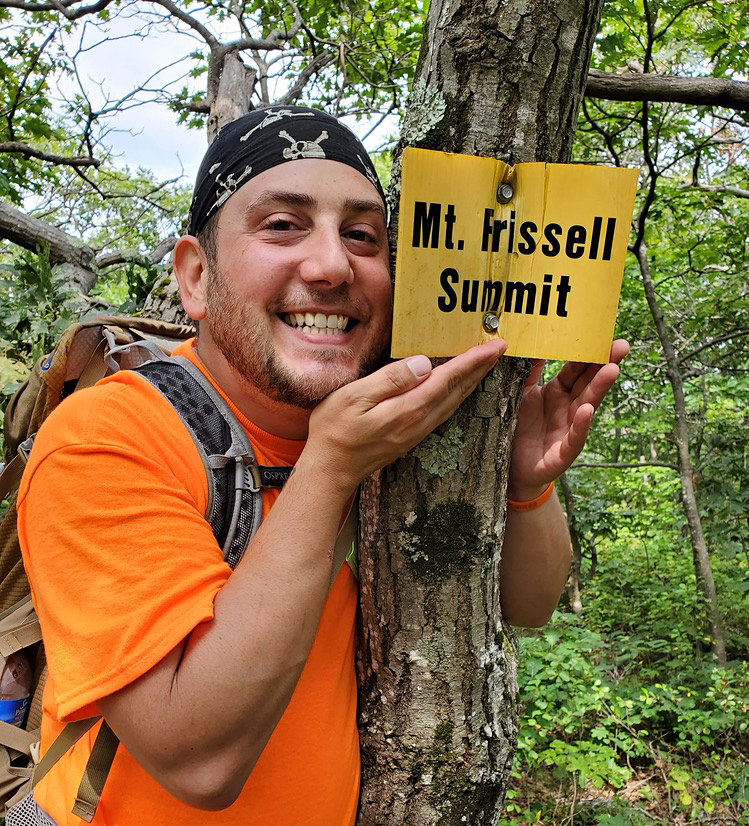
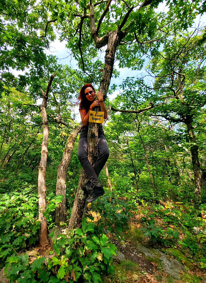
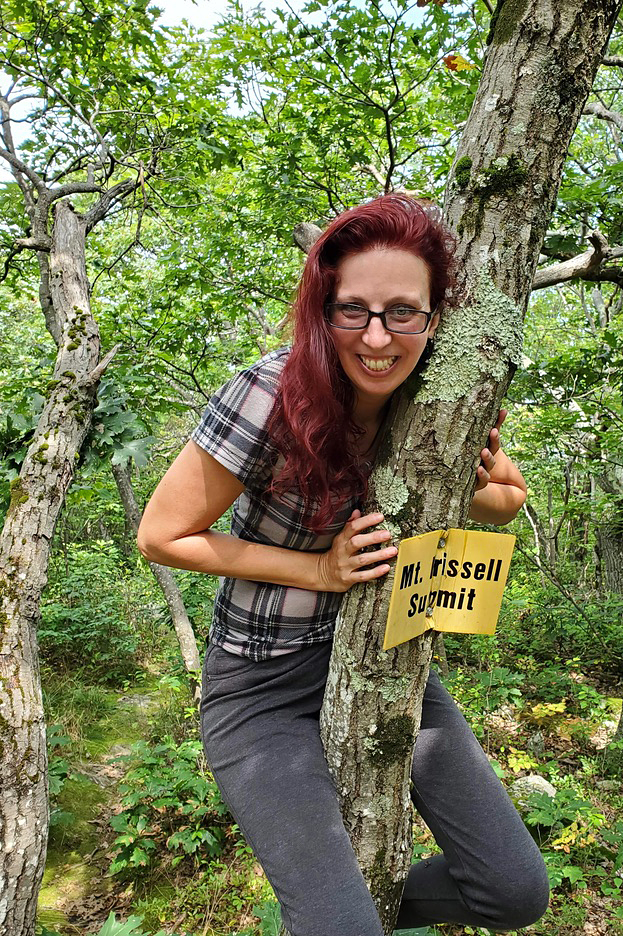
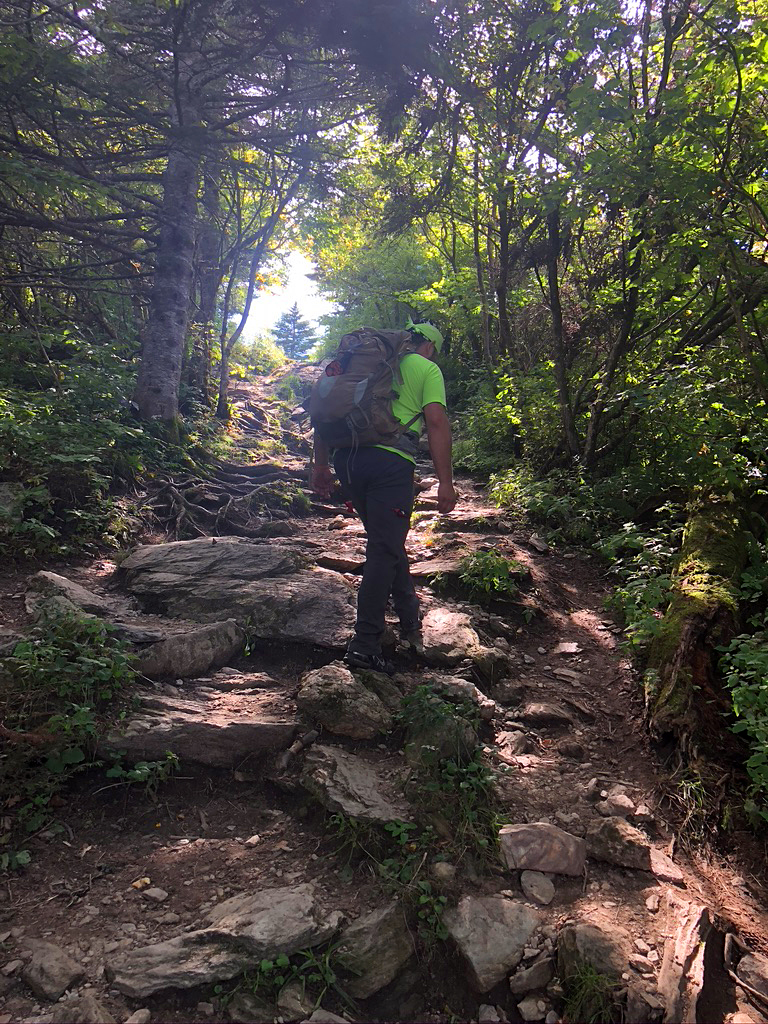
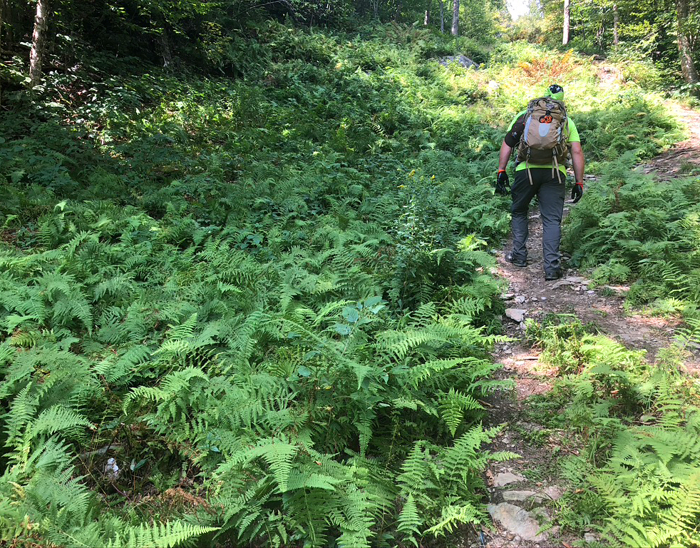
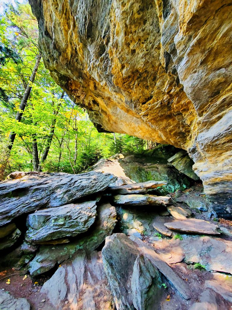
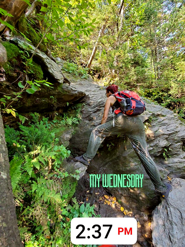
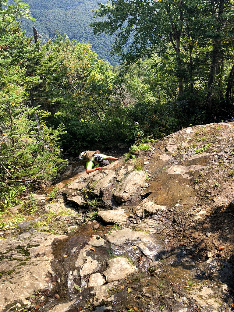
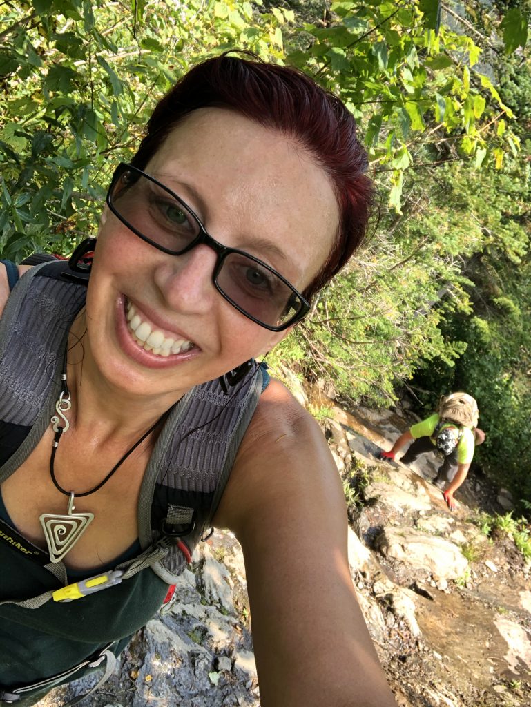
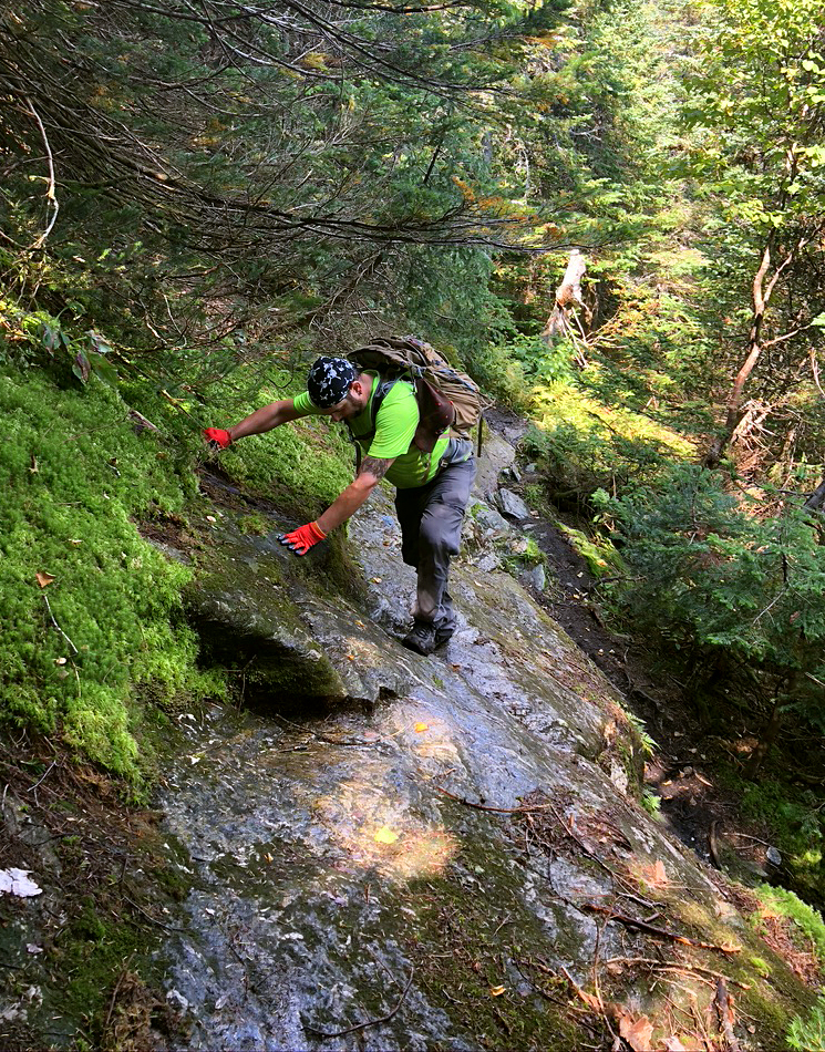
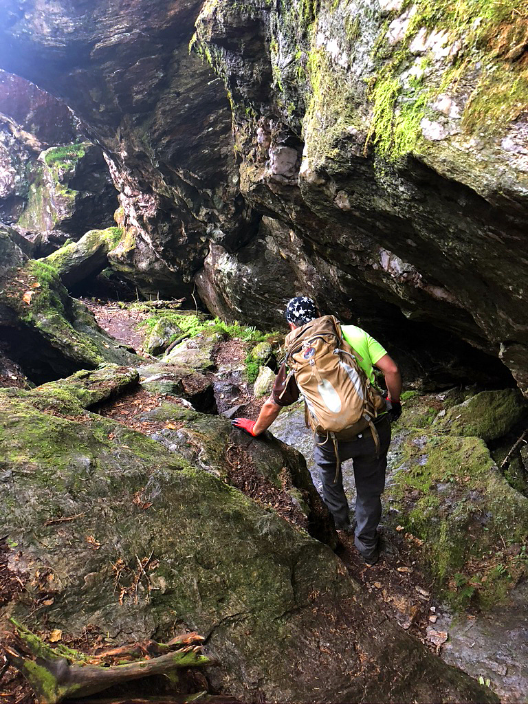
Monday, Sept. 7th: Since there was no tent to break down or showers to take, we were on Mount Frissell Trail by 11AM. The truck stop shower was optional, but we were about to get even more sweaty, so we opted out and just wanted to get going into the woods. According to the All Trails App, it was supposed to be a 2.3 mile trail, but my Pacer app said we did 3.4. We did go a little further past the trail wandering around, so that makes sense. The path was overgrown in some areas and was a very narrow trail overall. There were several steep rock scrambling parts. This trail actually takes you up up and over 2 mountains; Round Mountain and Frissel. Shhh, don’t tell Bryan that he did 2 mountains that day.
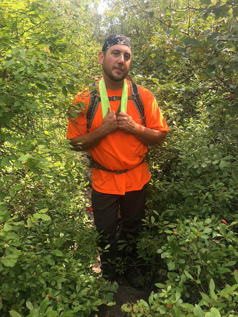
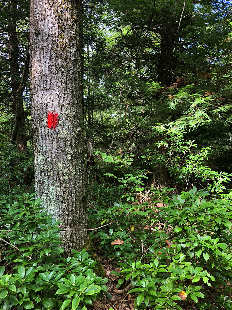
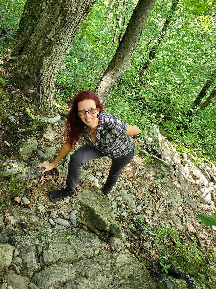
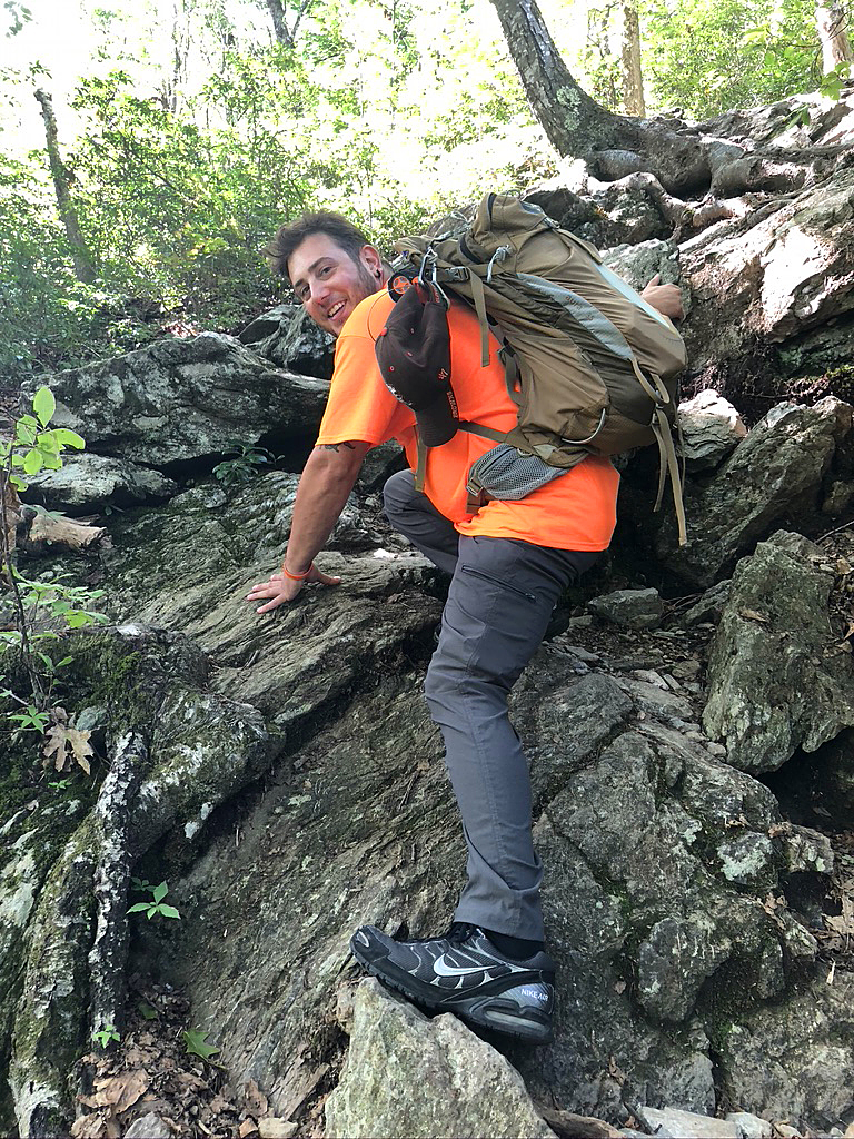
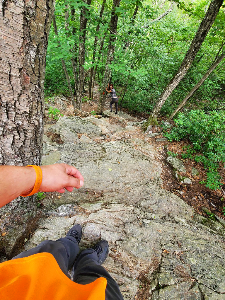
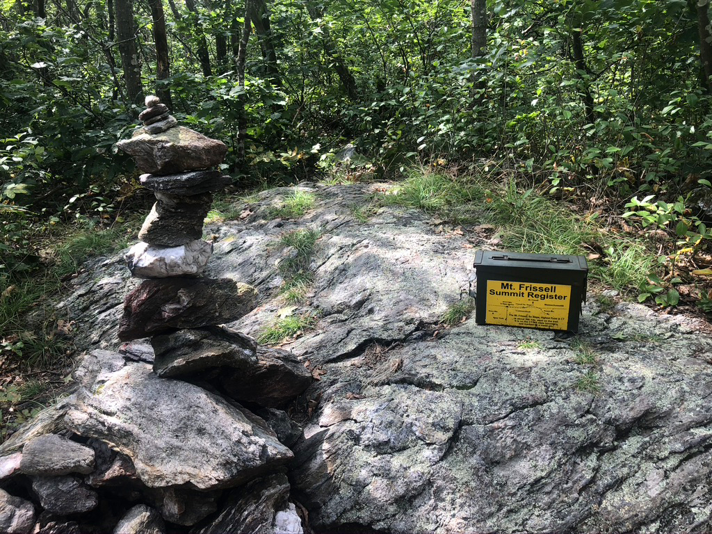
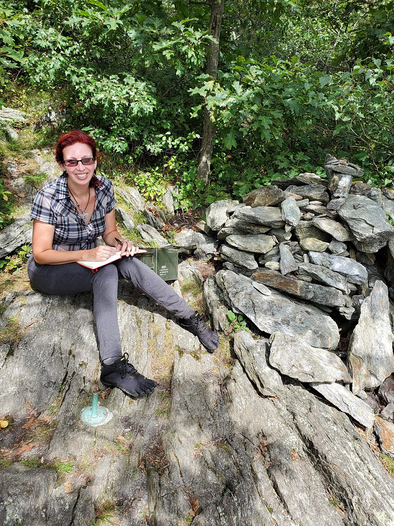
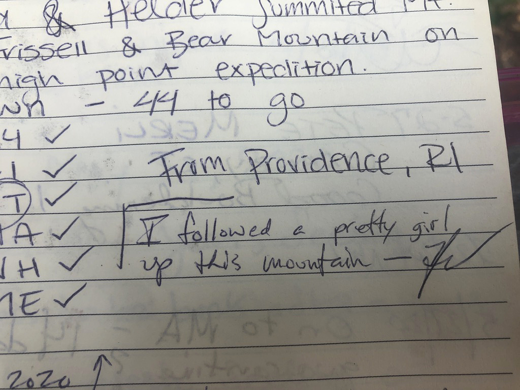
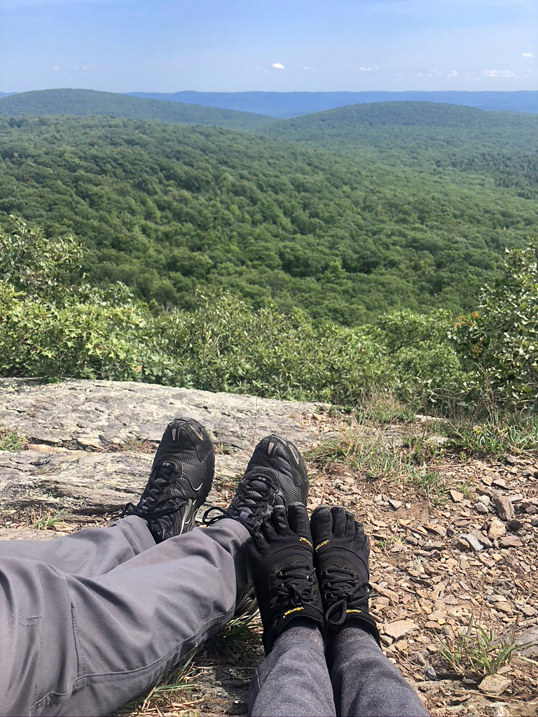
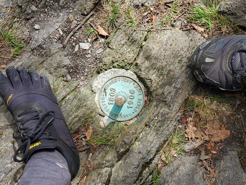
The sign marking the Connecticut’s highest summit was fairly lame. It was nothing more than a corrugated 8×10 board bolted to a tree. They also had a metal ammo box with journals to sign-in at. There was not much of a view from the Frissel summit because of all the trees, so many of our pretty photos are from Round Mountain with the spectacular views. We hung out there, snacking, taking photos and chatting with a dad and his 2 girls. At another great look-out, we sat and chilled with 2 guys for a moment. The one was trying to show us a black bear that one of them spotted in the valley below, but we never saw it. There was a brief thought that this was the summit of Frissel, but when I checked the map, I knew it wasn’t. Bryan didn’t seem to thrilled at me when I wanted to keep going, but then seemed happy when he saw the real summit that we came for. The signage was not the best on the trail, so following the map on the All Trails App is a good way to stay on track.
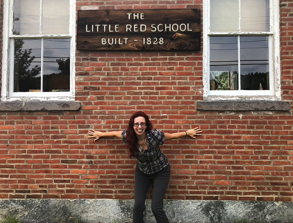
After conquering the highest peak in Connecticut, we drove 3 hours and 15 minutes to check out West Cemetery. But before we got there, we stopped along the road at The Little Red School. Aww…
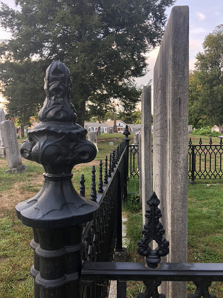
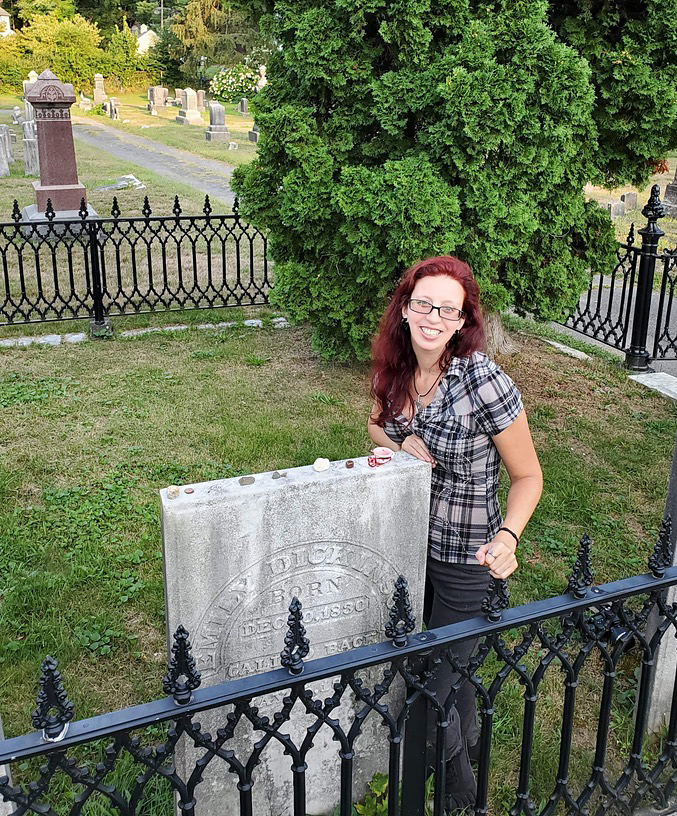
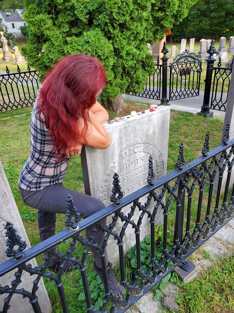
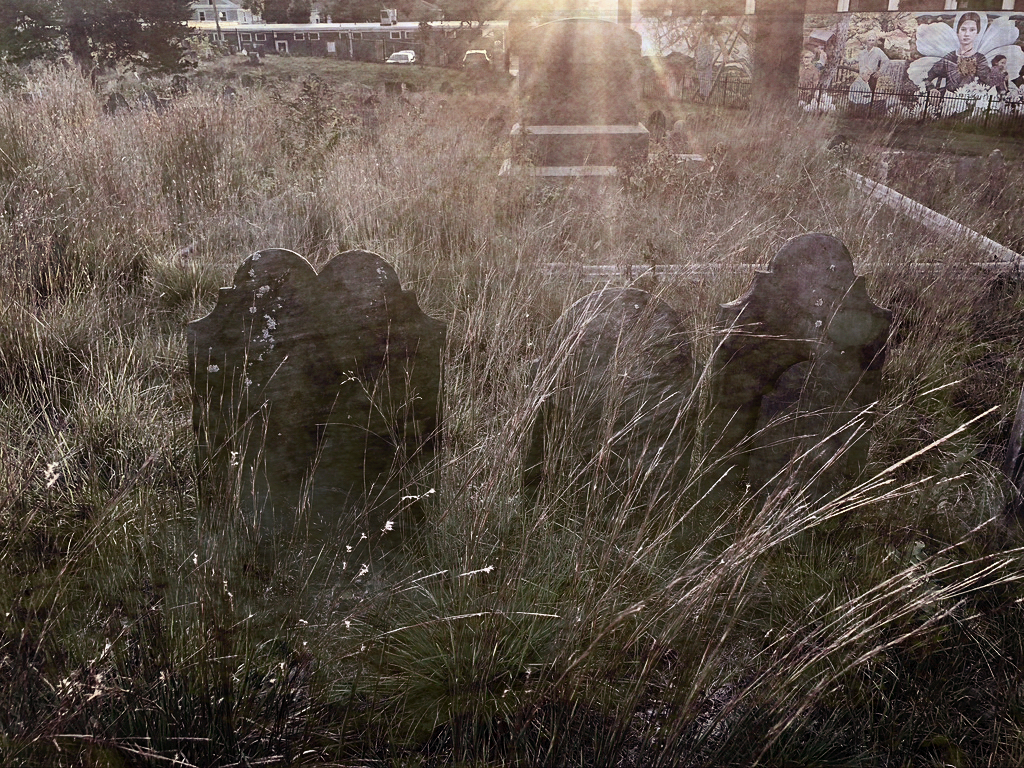
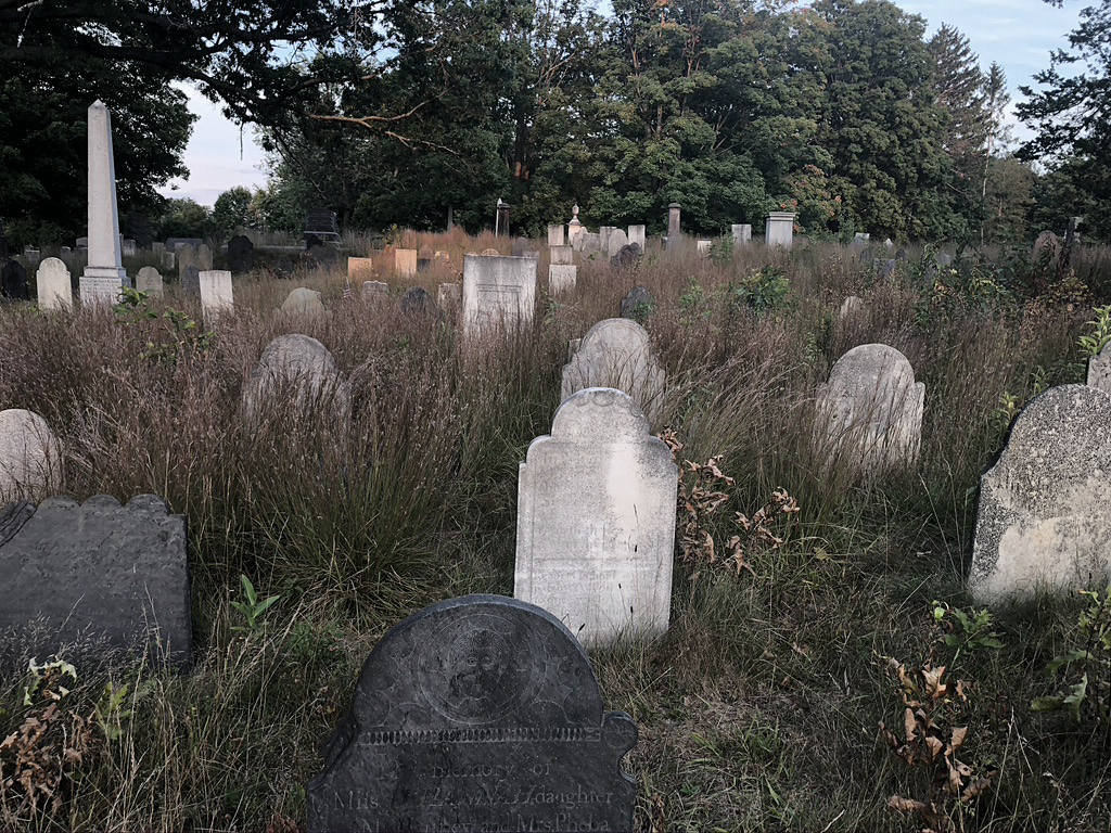
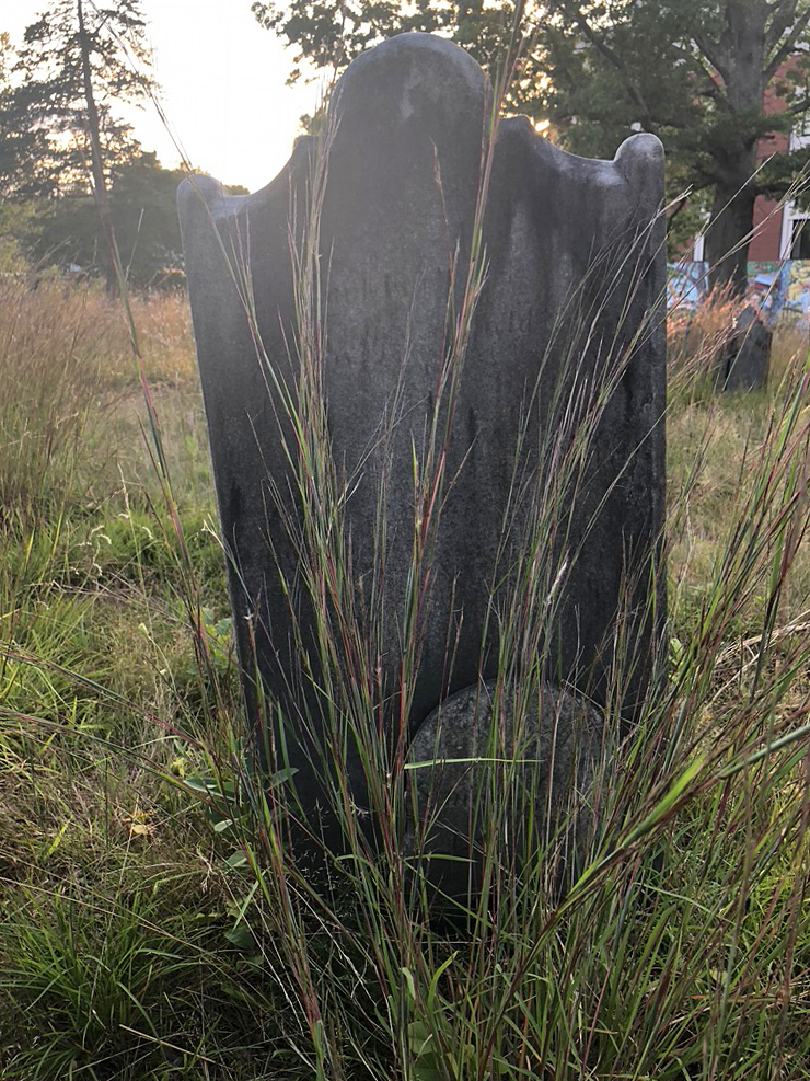
I planned on going to West Cemetery, to visit Emily Dickinsons grave, but the surrounding overgrown, spooky cemetery was a total bonus! The section where Emily is burred is mowed and maintained, but the rest of the ancient cemetery is very overgrown and eerie looking. I had a great time rustling around through the high grass exploring. The sun was starting to set and the entire scene was ghostly. Perfect.
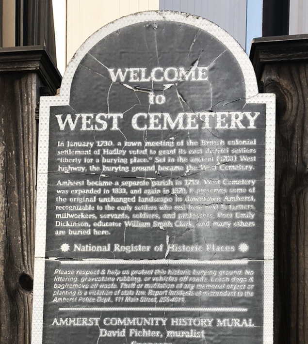
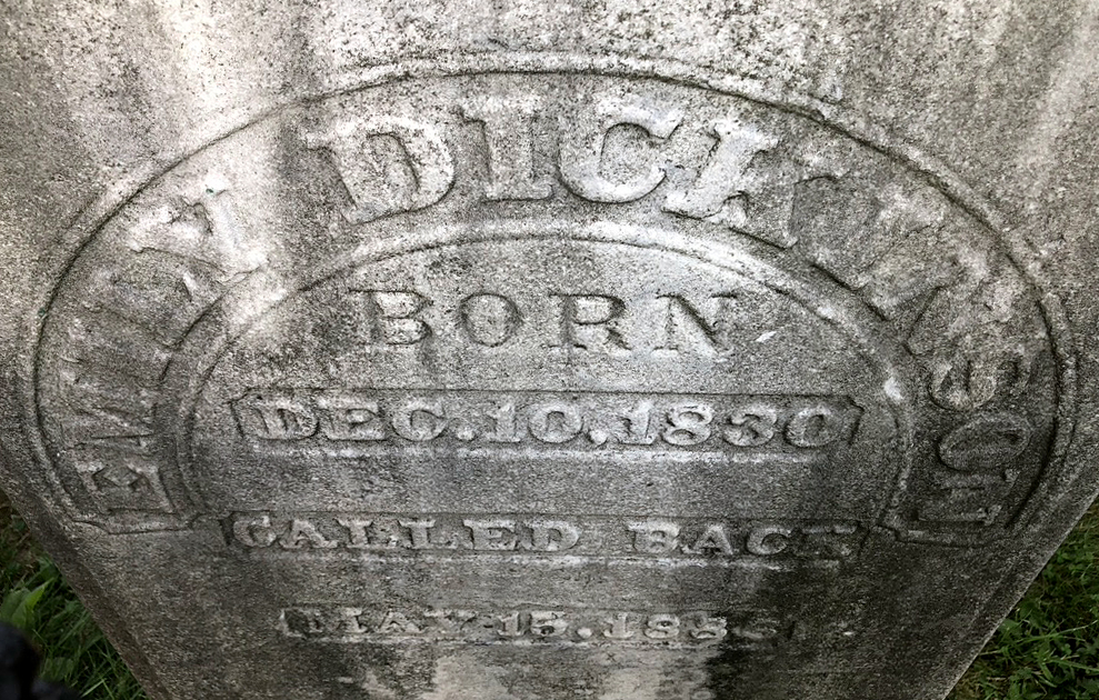
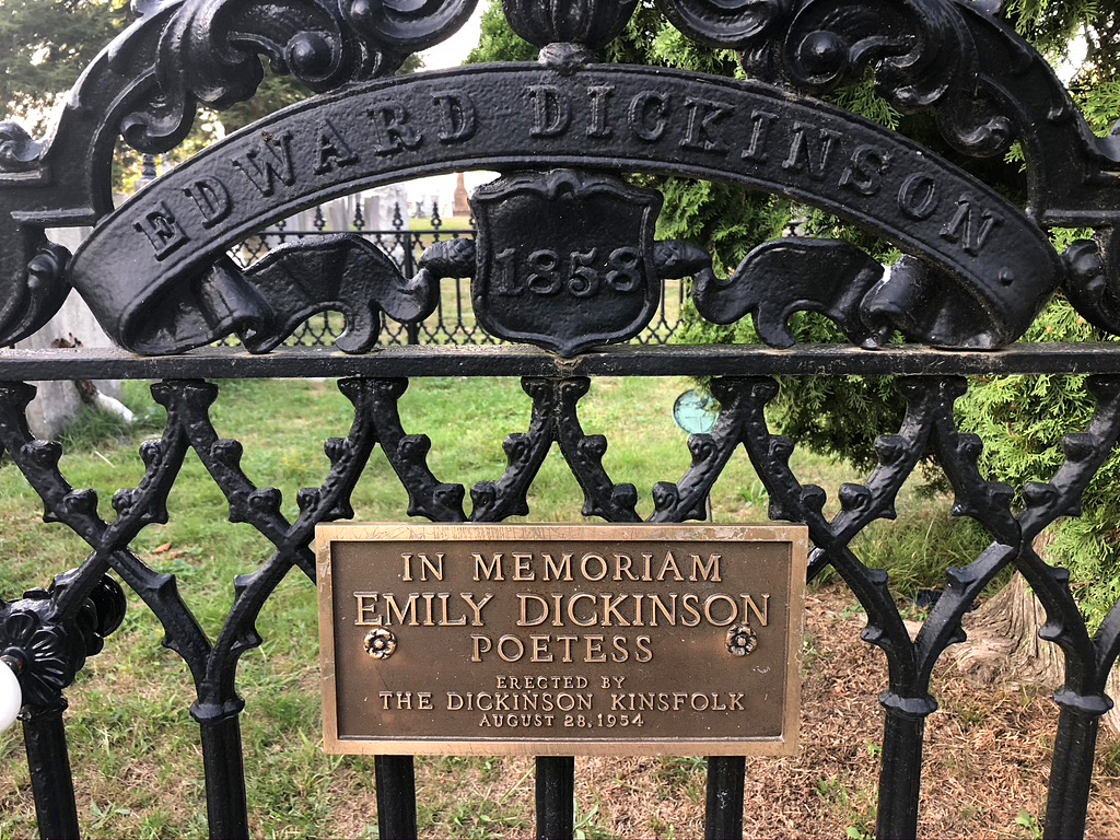
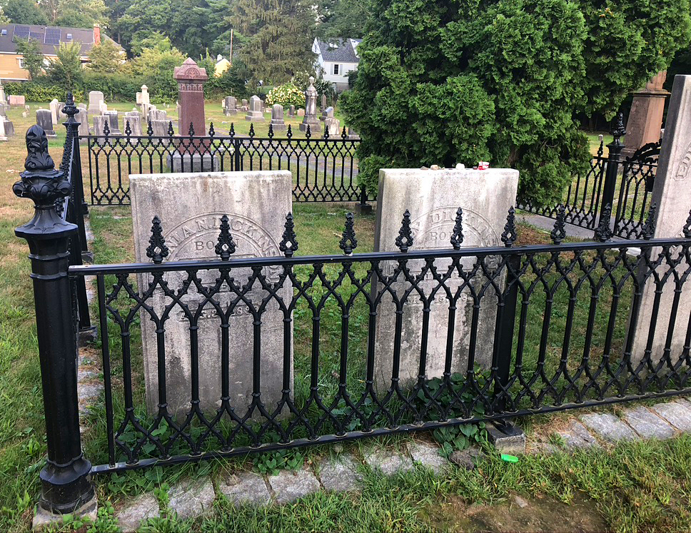
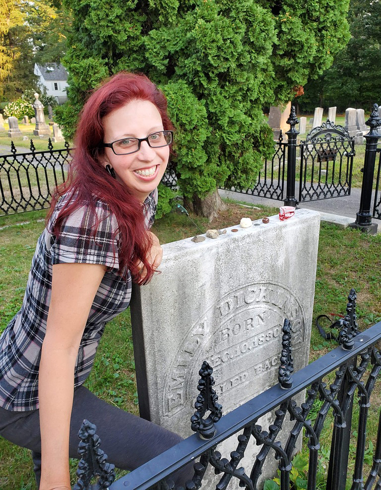
What I want to know is, why is Emily’s gravestone butted up so close to the rod iron fence, that you can’t get a good photo or view of it? It looks like whomsoever’s job it was to place the families stones in the fenced in area, did it wrong. Very wrong. Very strange.
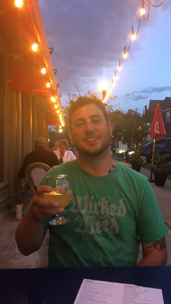
After Bryan dragged the creepy girl out of the overgrown field of death, we went a few minutes away in Amherst Center for dinner. We had an awesome dinner and drinks on the patio at Johnny’s Tavern. The sun was just setting and we sat under twinkling white lights with a cool breeze to air out our stinky hiking selves. I had a huge salad with avocado and fennel and Bryan had the Grilled Vegetable sandwich. I had a strong Spicy Cilantro Margarita while he had local beer called Focal Banger from the Alchemist Brewery.
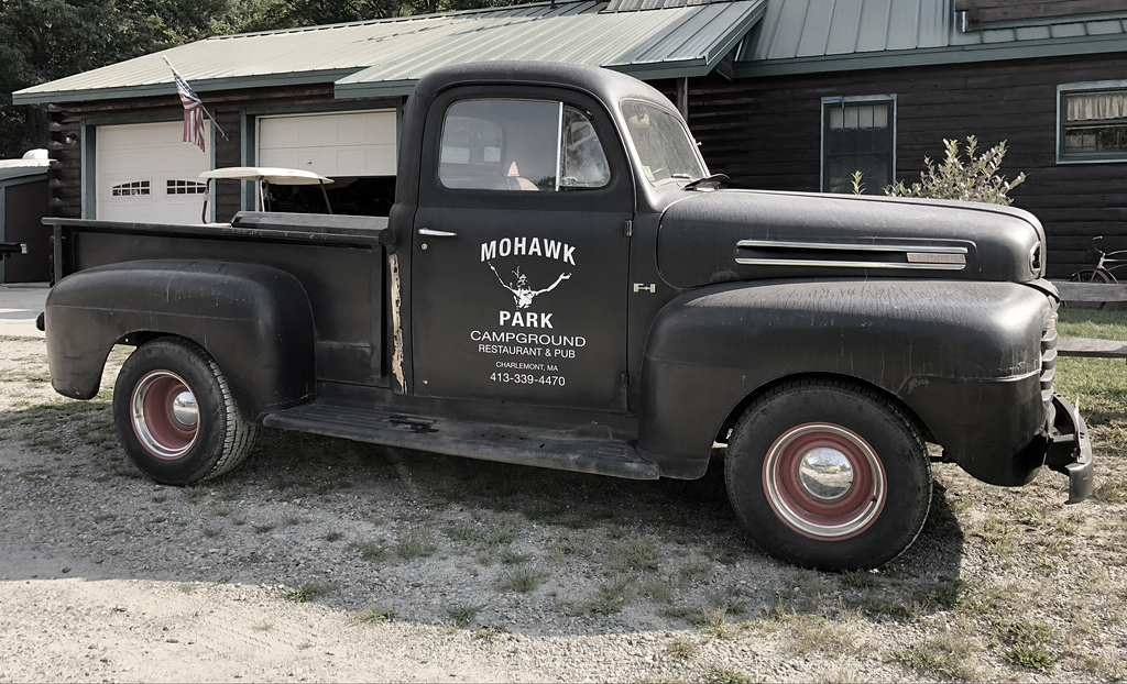
About an hour away was a campground that I had found earlier called Mohawk Park Campground. We were lucky to find a place. Bryan set up his tent and I got my hammock set up while drinking wine. We fell asleep listening to Deerfield river flowing right next to us…
Tuesday, Sept. 8th: Sometime around 4:30AM, I was woken up to intense cramps and the start of my period. That’s pretty much the last thing I wanted to happen the night before the steep trail we had planned. I never went back to sleep and I was tired, in intense pain and miserable, But nothing was going to stop me.
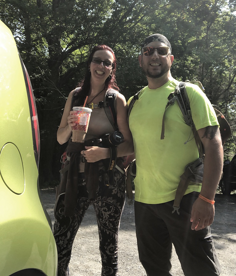
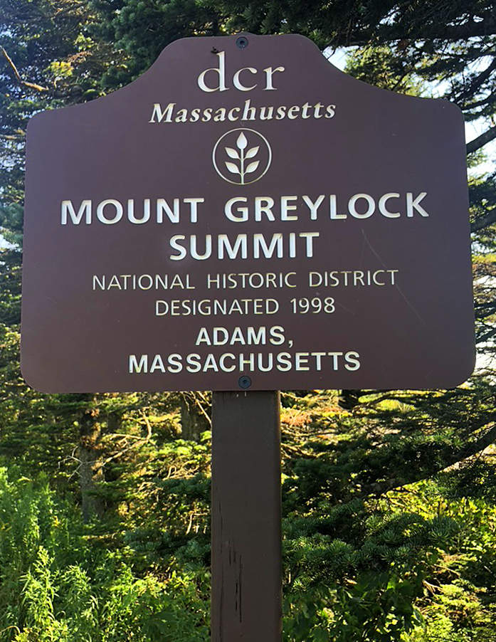
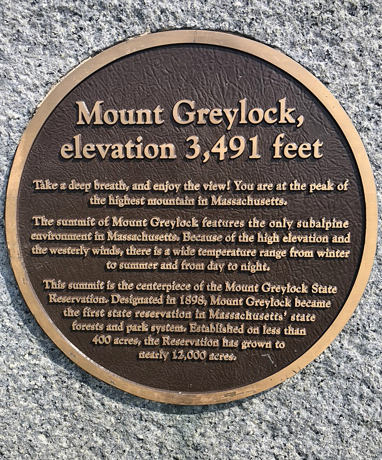
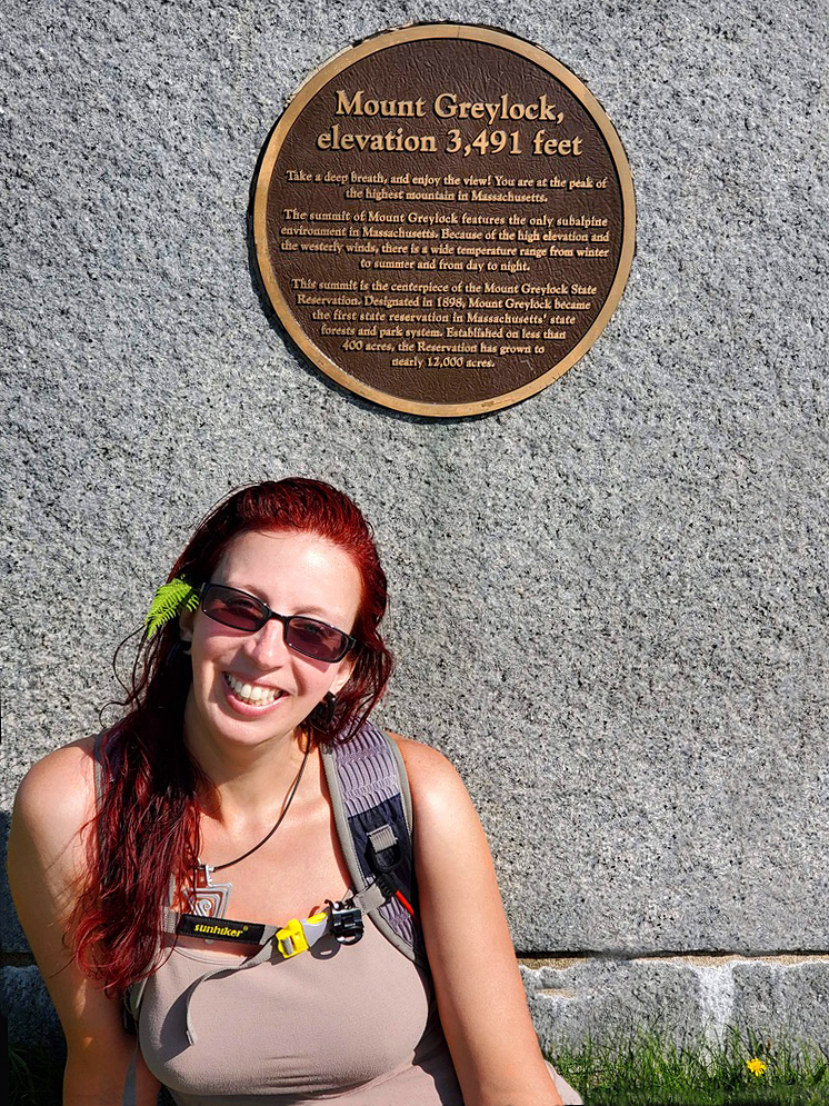
I laid there and waited until Bryan woke up. Once showered and packed up, we grabbed Dunkin Donuts Iced Chai and some quick breakfast to go. Our camp was just an hour away from Mount Greylock, the highest peak in Massachusetts. We were at the trailhead by Noon.
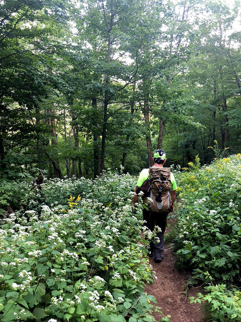
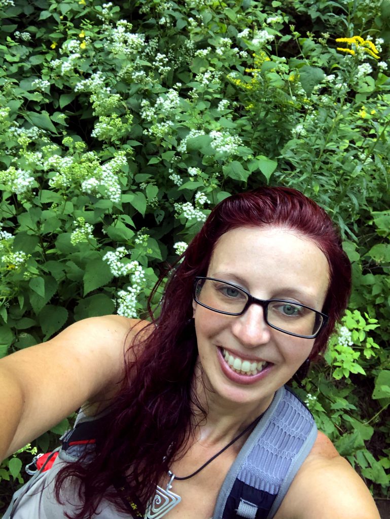
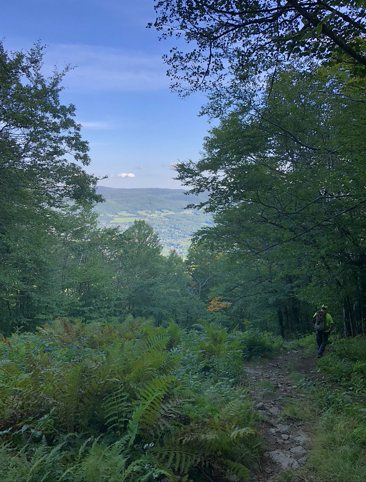
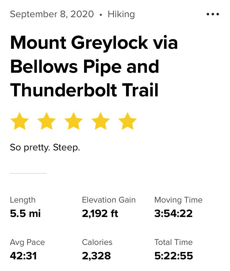
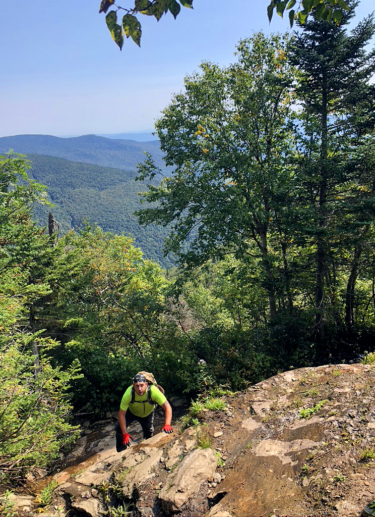
Now lets talk more about this trail…We picked Thunderbolt trail because we wanted a challenging, but shorter trail, mileage wise. I had heard stories about how steep Thunderbolt was and needed to do it: up and down. The reviews were very true. It was all UP the entire time. Bryan estimates that it was about a 45º angle the entire trail. It was not very technical, but steep, steep, steep. Truly a pretty path. At one point, it was all lush green ferns filling up a valley as far as you could see. That inclined stretch of green, led into a magical view of tall wildflowers. White, yellow, green and purple blowing in the mountain breeze.
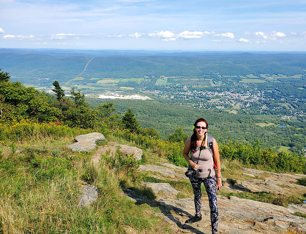
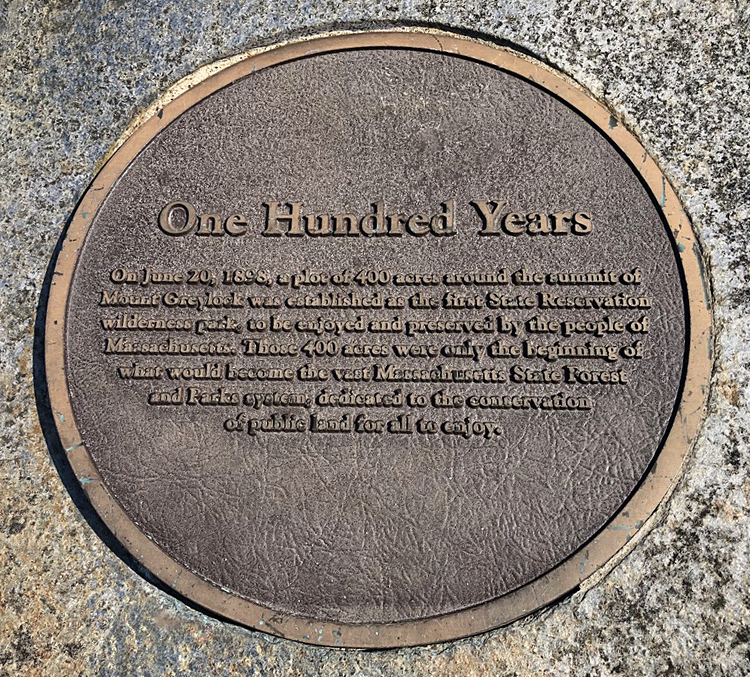
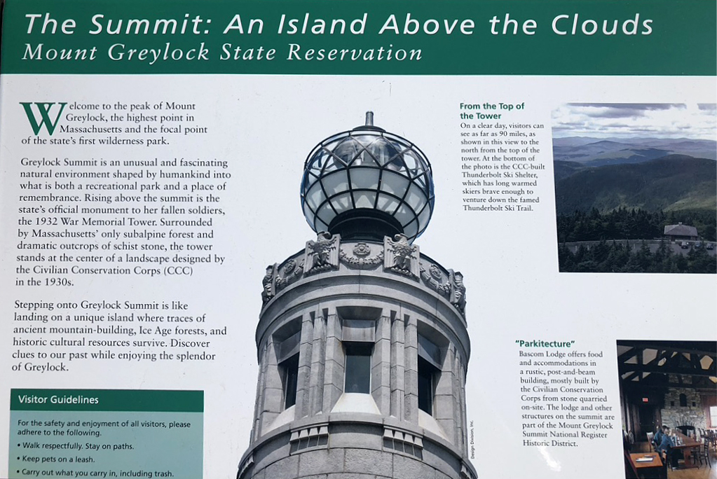
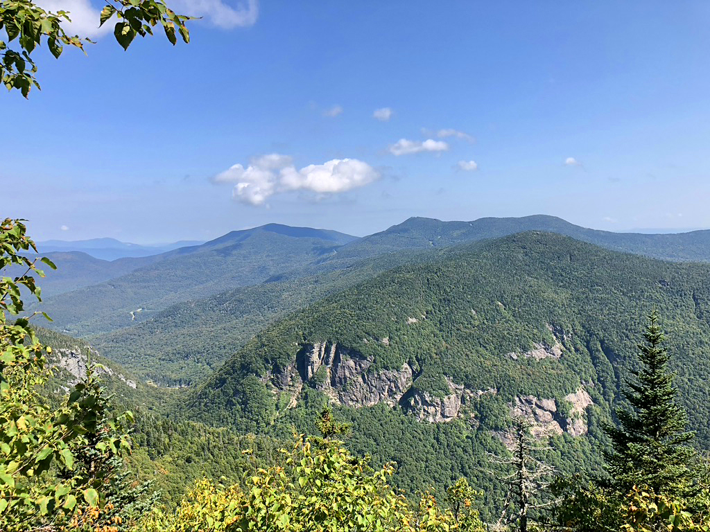
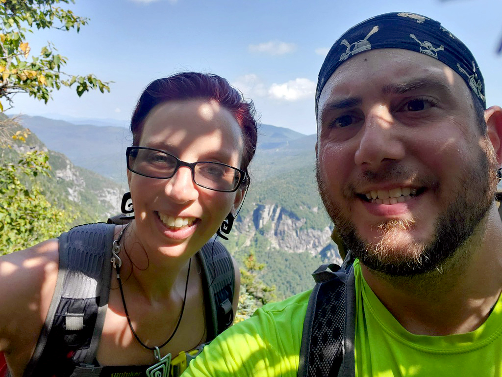
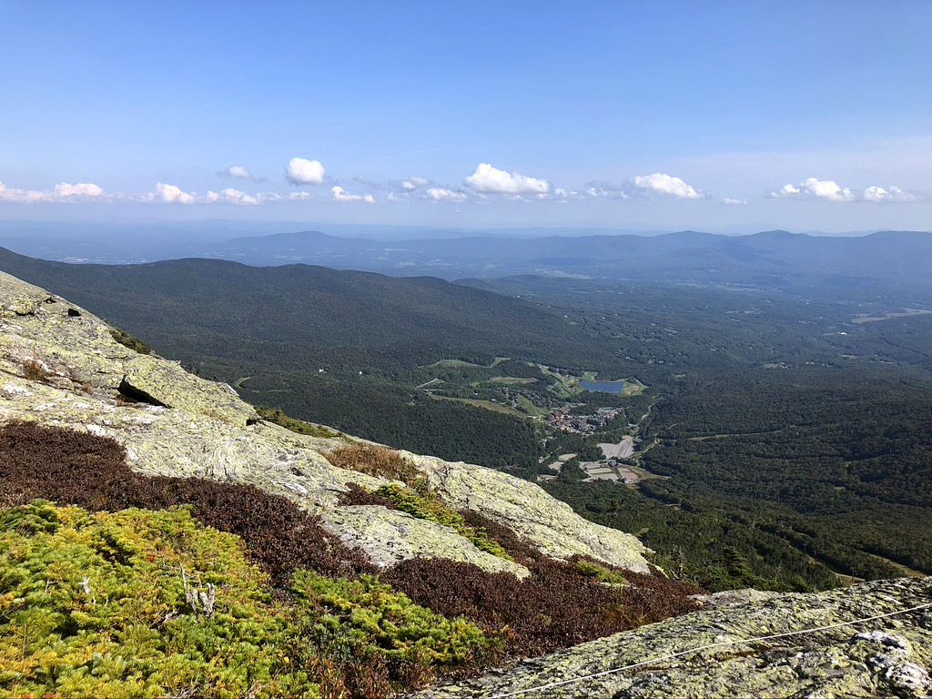
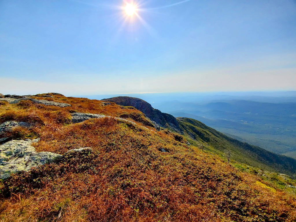
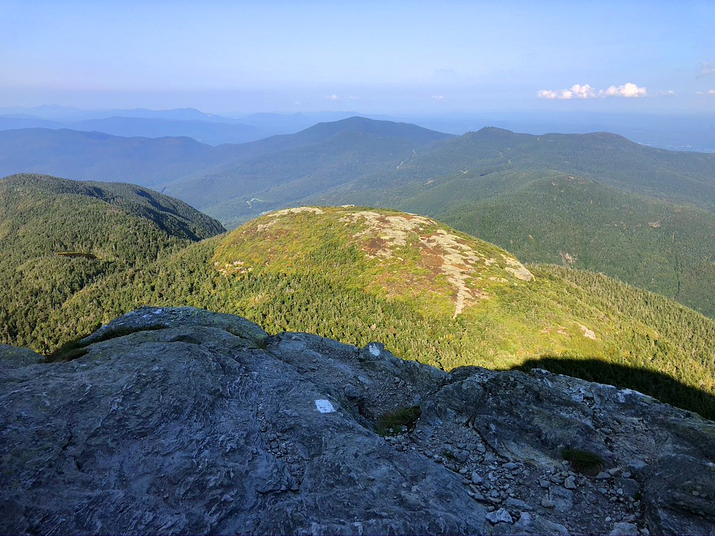
Once you are approaching the summit, the dense forest opens up to an awe inspiring view. I actually gasped. At 3,491 feet, Mount Greylock is the highest point in Massachusetts. From its peak on a clear day, you can see as far as 90 miles away. We defiantly had a clear day! The gorgeous view allows you to see into five different states: Massachusetts, New York, Connecticut, Vermont, and New Hampshire.
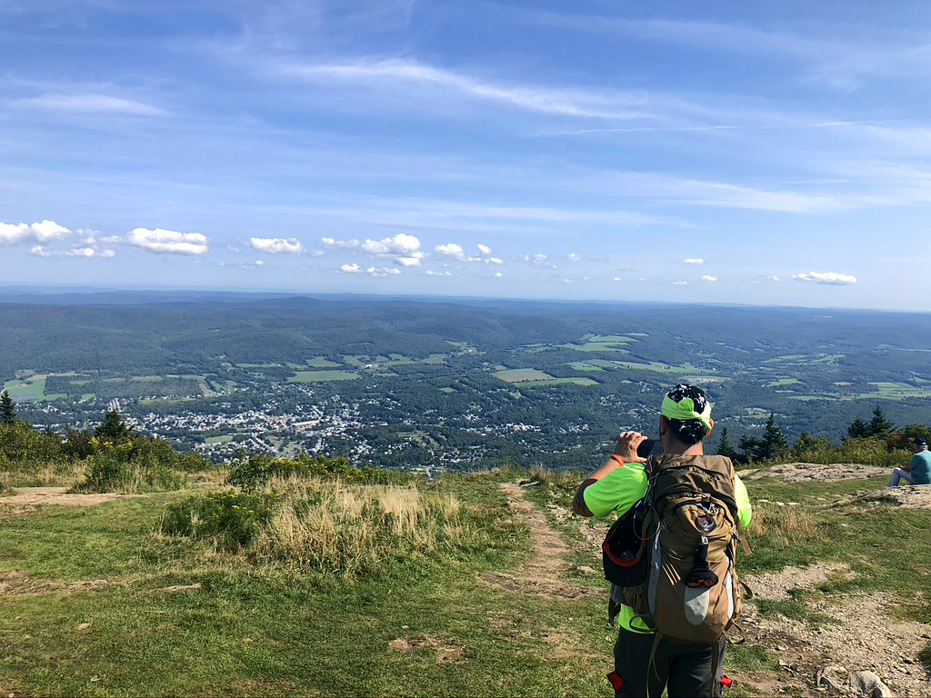
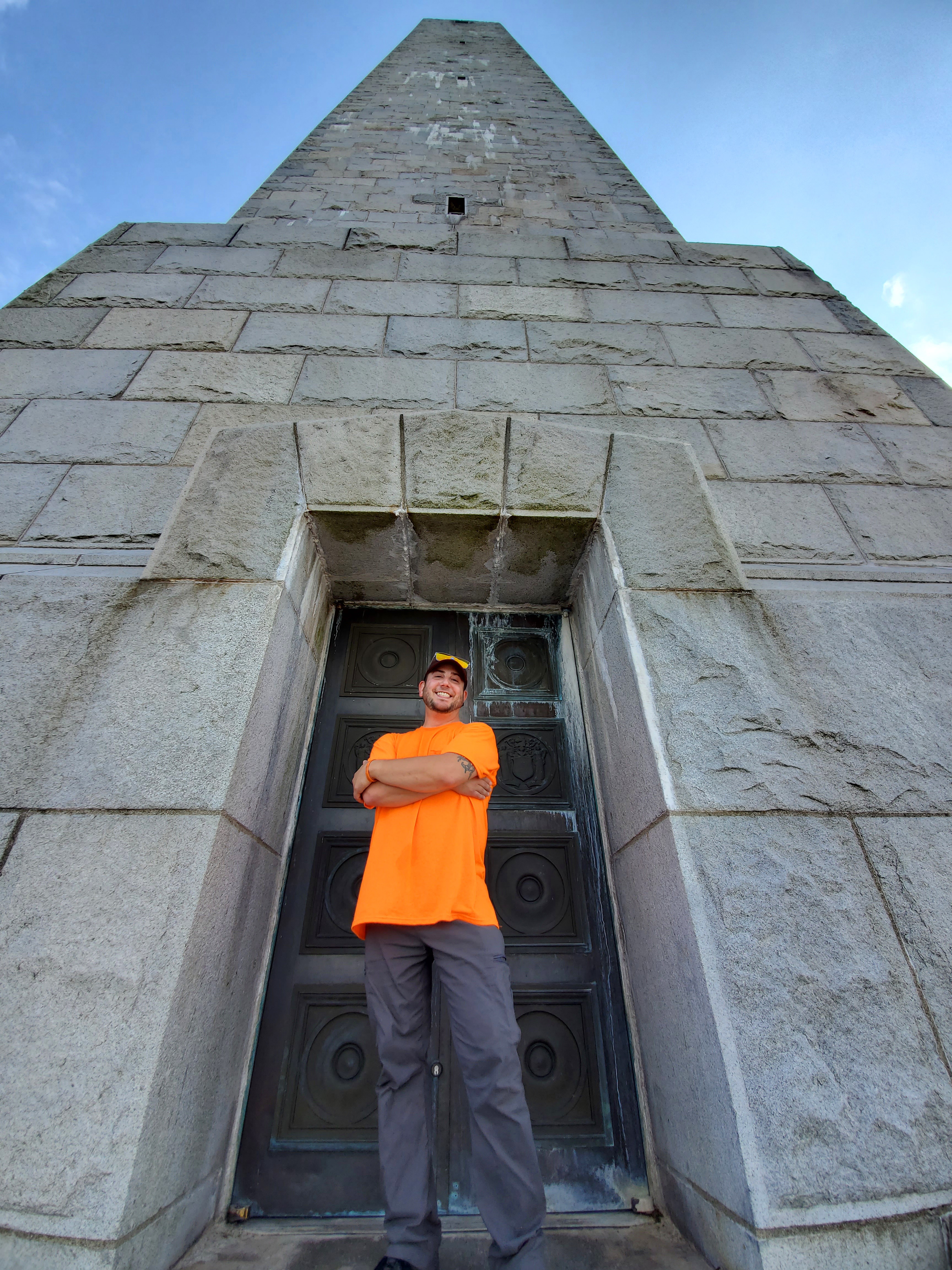
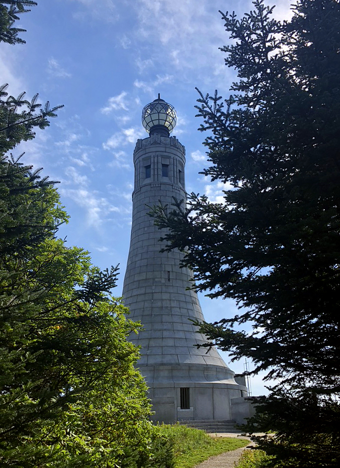
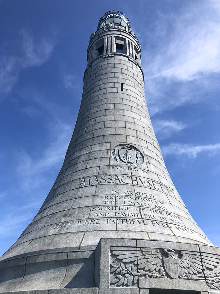
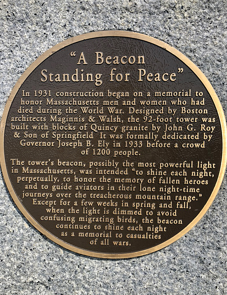
You can’t miss the Veteran’s War Memorial Tower at the summit. It starts to come into view, moments from hoping out of the woods. It’s a huge marker honoring all those who have given their lives in defense of the nation.
So apparently, the popular thing to do is to take Bellows Pipe Trail to Thunderbolt Trail up to the summit then descend down along Bellows Pipe only, but it would have added many more hours and miles on an unfamiliar route. Bryan most definitely wanted to take an alternative (less steep) route back down, but I tried to convince him otherwise. He begrudging agreed and we focused and let gravity help us fly down quickly. Yeah, he hated me. Wee…
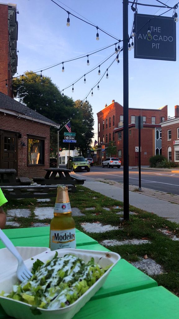
We got off of the mountain around 5:30. By 6:30, we were scarfing down amazing Mexican noms from The Avocado Pit in Bennington, Vermont. The mom and pop Chipotle type place had an enthusiastic guy that was proud of his Zhoug Sauce. We had to try it! It was a yummy, spicy, cilantro based topping for our veggie bowls. During dinner, we tried to find a place to camp, so we could have a much needed shower. We got super excited when Underhill State Park said that they had an opening. So, we drove the 3 and a half hours to get there and position ourselves closer to Vermont’s high peek. Except, the one time that I forget to ask if they have a shower…turns out that they don’t, and its a walk-in camp site only. Sigh…
It was around 11:30 at night, tired and in need of showers, when we finally found Smugglers Notch Visitor Center and crashed there. From what I could see, it was just a parking lot with port-a-potties. Not what we were looking for, but it would have to do. At least the Port-a-potties were clean.
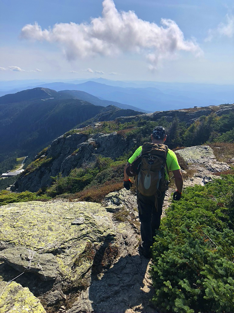
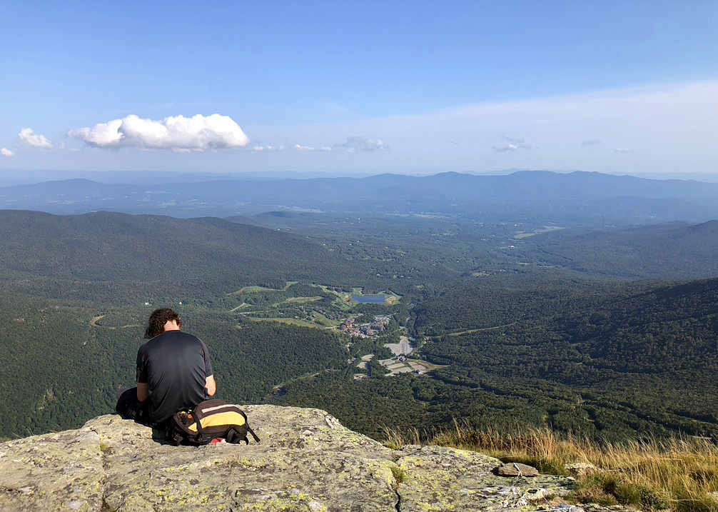
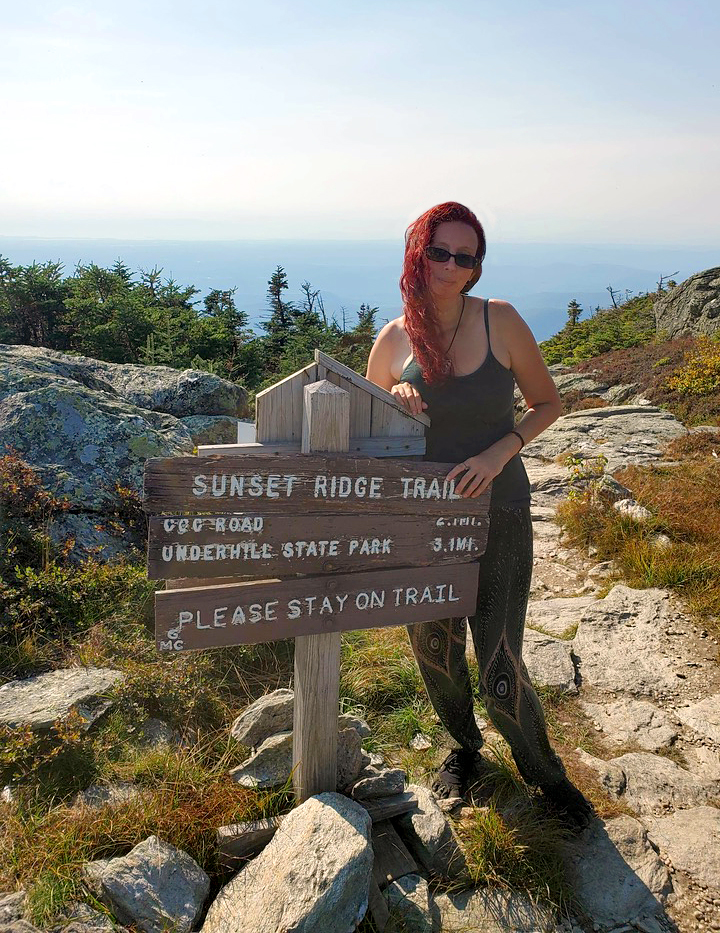
Wednesday, Sept. 9th: I didn’t sleep much again because of the car camping situation with Bryan snoring in the front seat and feeling like crap. We were up early because of all that and decided to get going. I was sure glad I brought baby wipes, though. I took a baby wipe bath to try and feel kind of normal and ate some car snacks. Then we headed down the road 30 minutes to jump on another mountain. Mount Mansfield, Vermont’s Highest Peak, was going to be harder than all the others we had done on this trip and I was in more pain than the day before. Just keep on swimming.
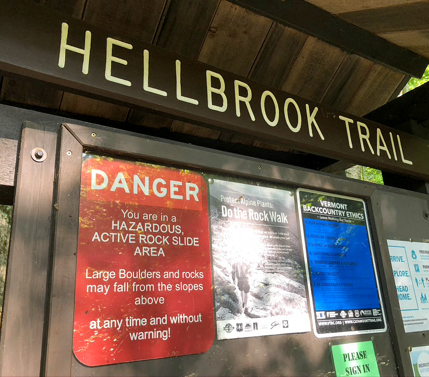
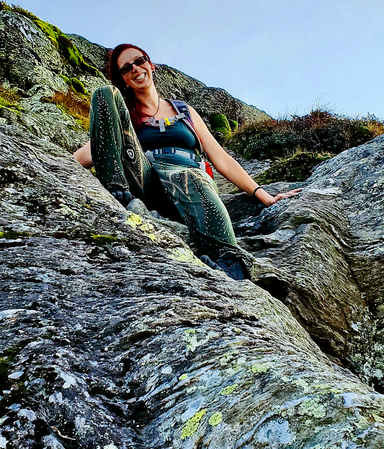
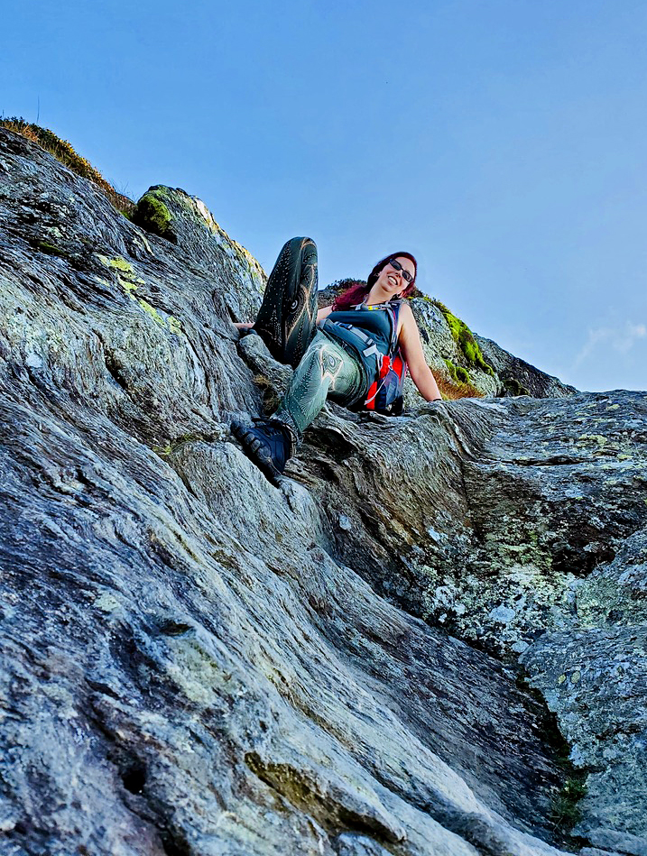
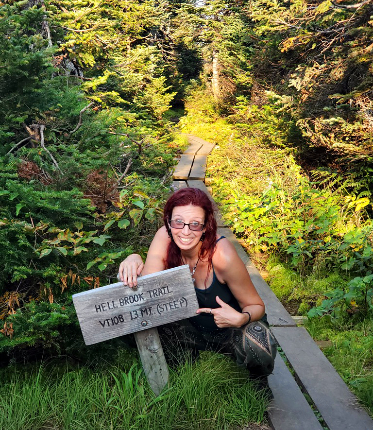
We were at The Hellbrook Trailhead by 9:30AM! Getting to the trailhead already included a steep ditch with water and Bryan was already telling me that he hated me again. Bahahahahahaha The trail was vertical immediately and stayed vertical the.entire.time. We picked the shortest, but steepest path. But it was also the most technically difficult route to the summit.
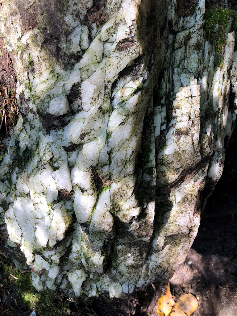
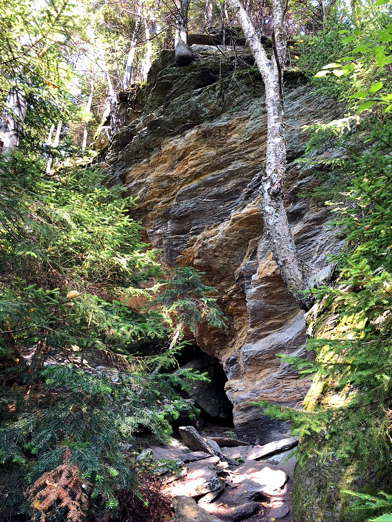
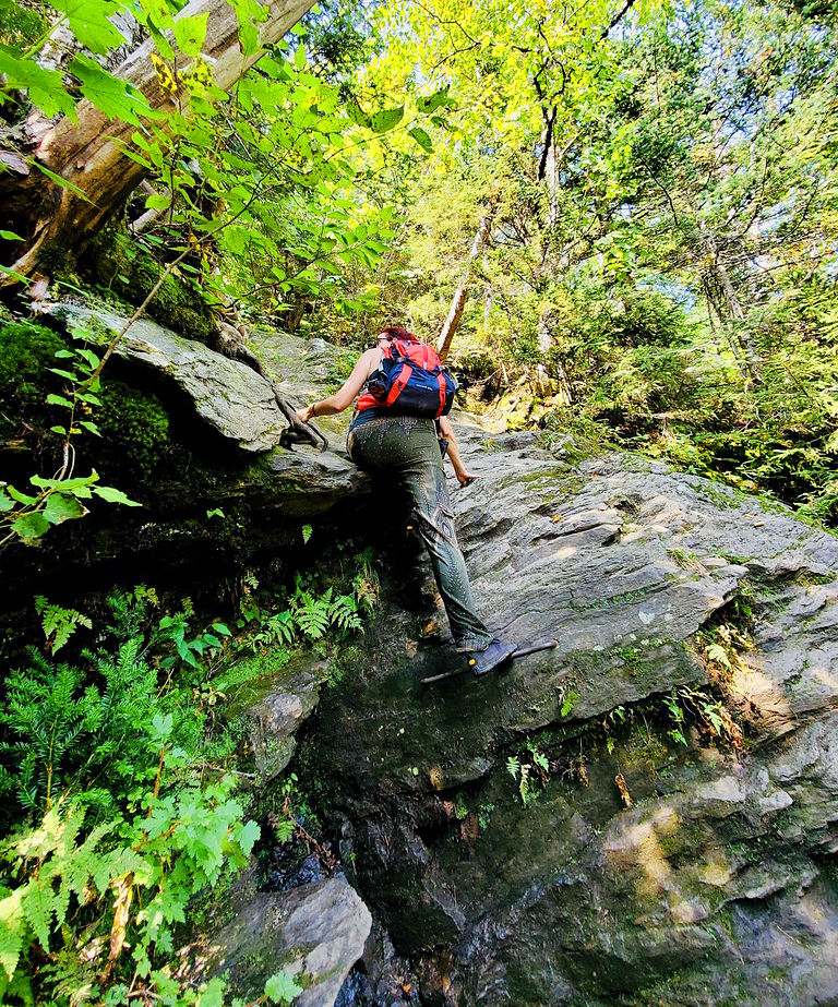
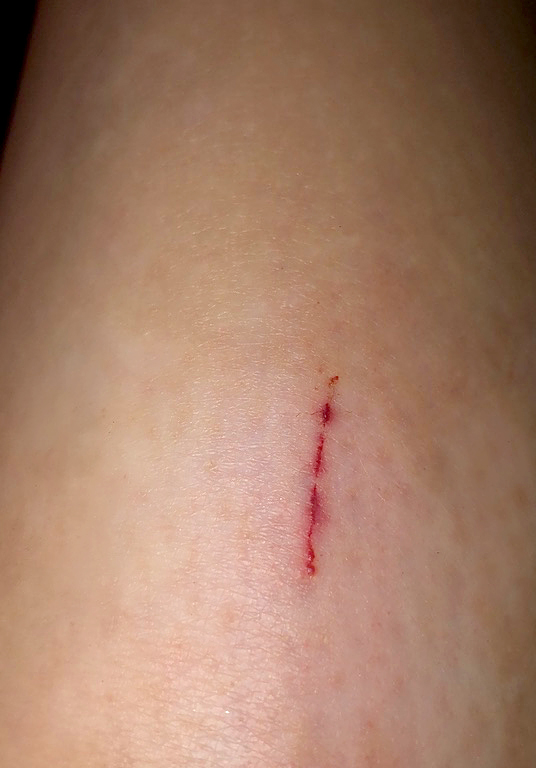
Hellbrook lived up to it’s name, for sure. It was hot, wet, steep, humid and did I mention steep? We were already drenched in sweat, just a half hour into the intense climb. At about the 2 hour mark, is where Bryan learned what iron rungs were. There were only 2, but should really have been one more. He slipped and banged up his shin reaching for the second one and almost missed it. His choice was to either fall off the mountain and die or bash his shin into rocks while reaching for the life support bar. Luckily, Mansfield only bruised and scratched us both up, and nothing major.
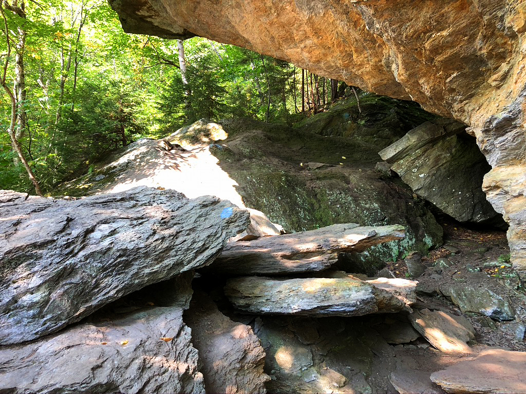
At one point, a guy came flying down what seemed like an impassable section like a mountain lion! He saw how haggard we were and told us that we were almost there. HE LIED! At .8 miles, I remember looking at my phone in disbelief. How have we only done .8 miles!? I kept reminding Bryan, and myself, that the entire trail is only supposed to be 3.7 miles. IT LIED! 6.5 miles. That’s what my Pacer app said. There were a couple points of confusion where we got off trail a bit, but not that off. Bad signage. Bad mileage. It does not seem like many miles, but when they are hard and all vertical miles…holy hell.
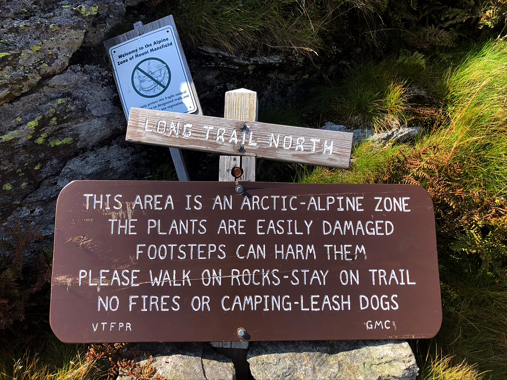
So, there was a point that I was so sure was the summit, that we stoped for a snack break. Nope. We were just at the Arctic Alpine Zone of the mountain. Amazing view, but not the summit…
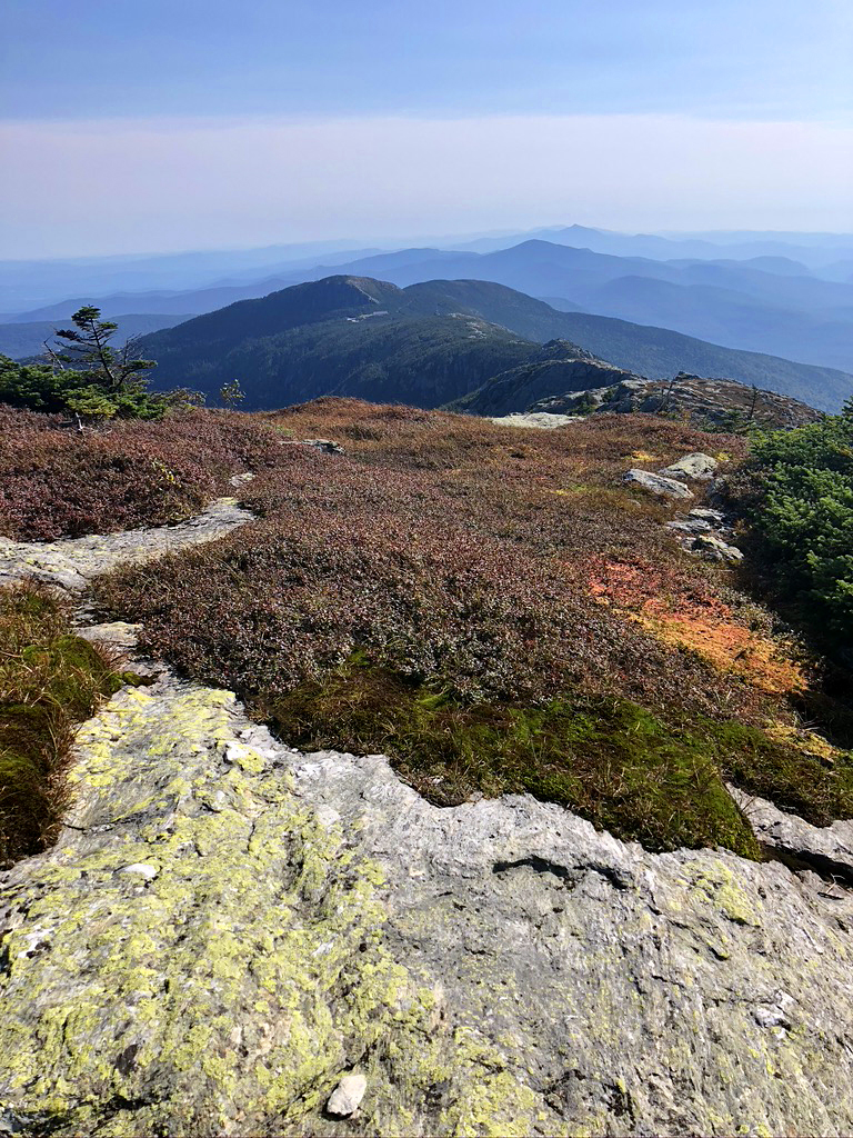
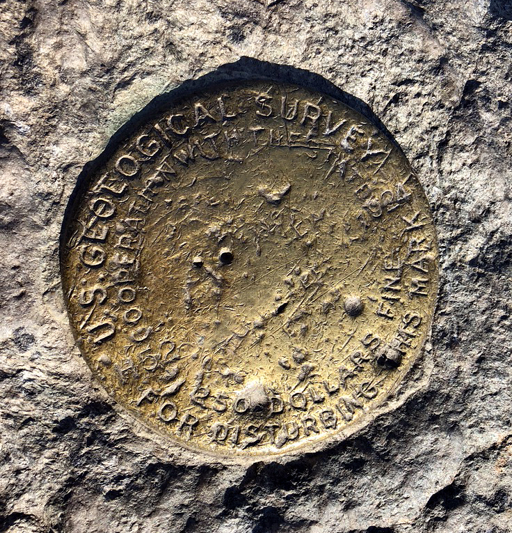
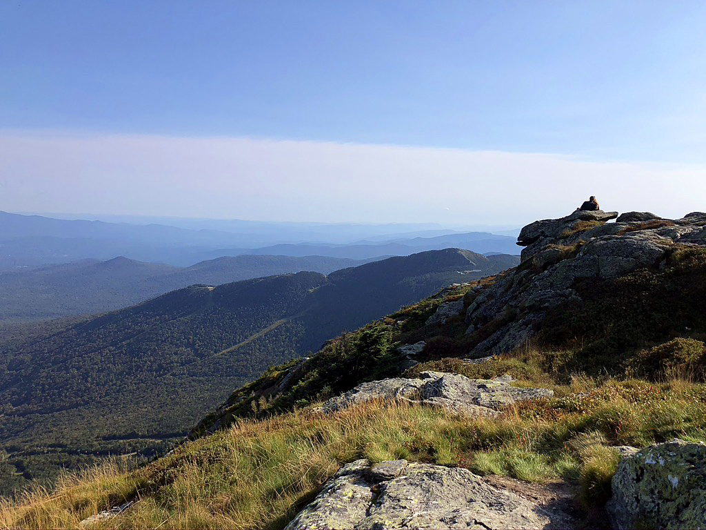
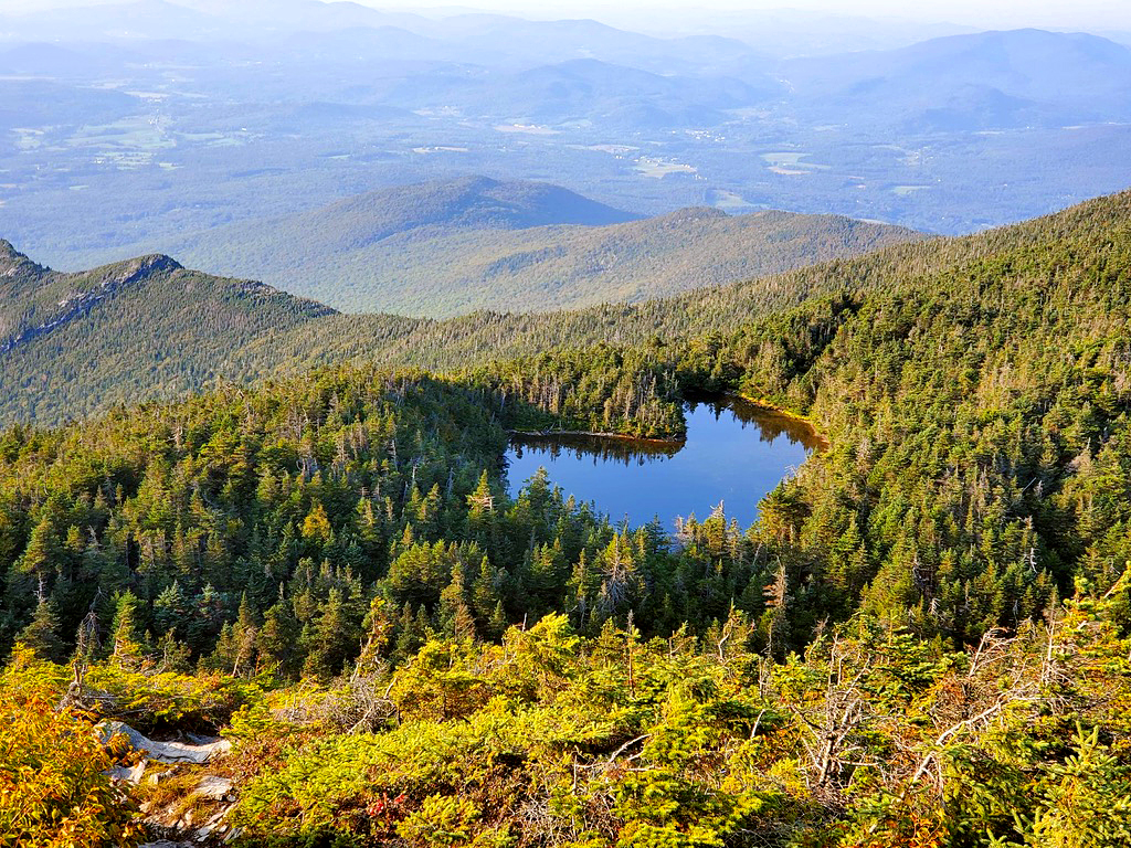
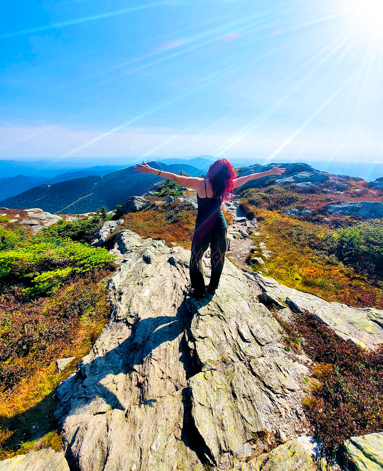
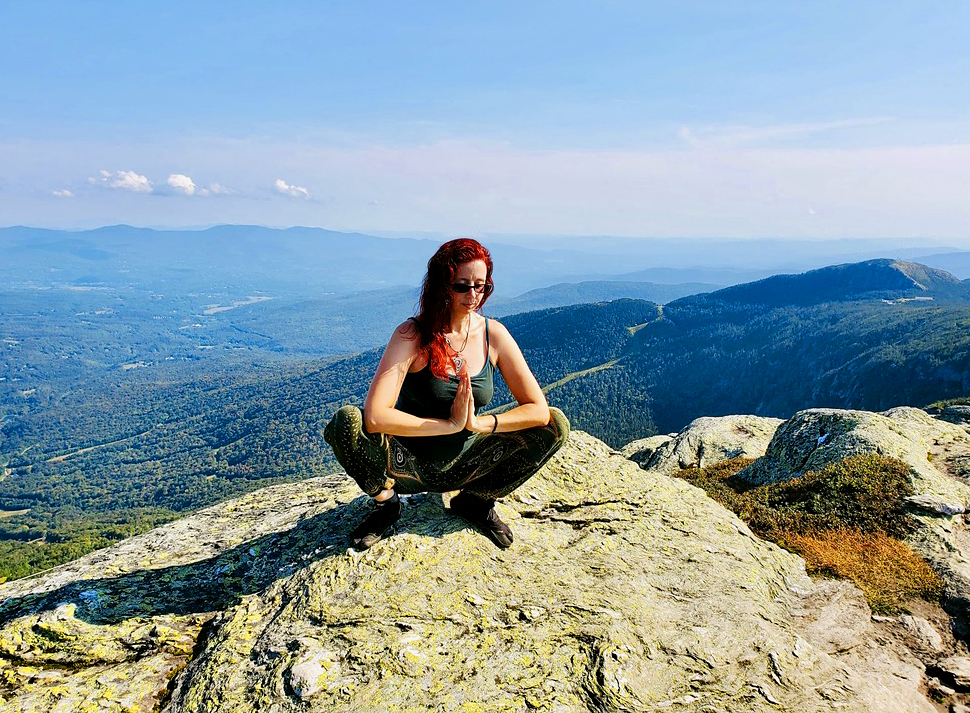
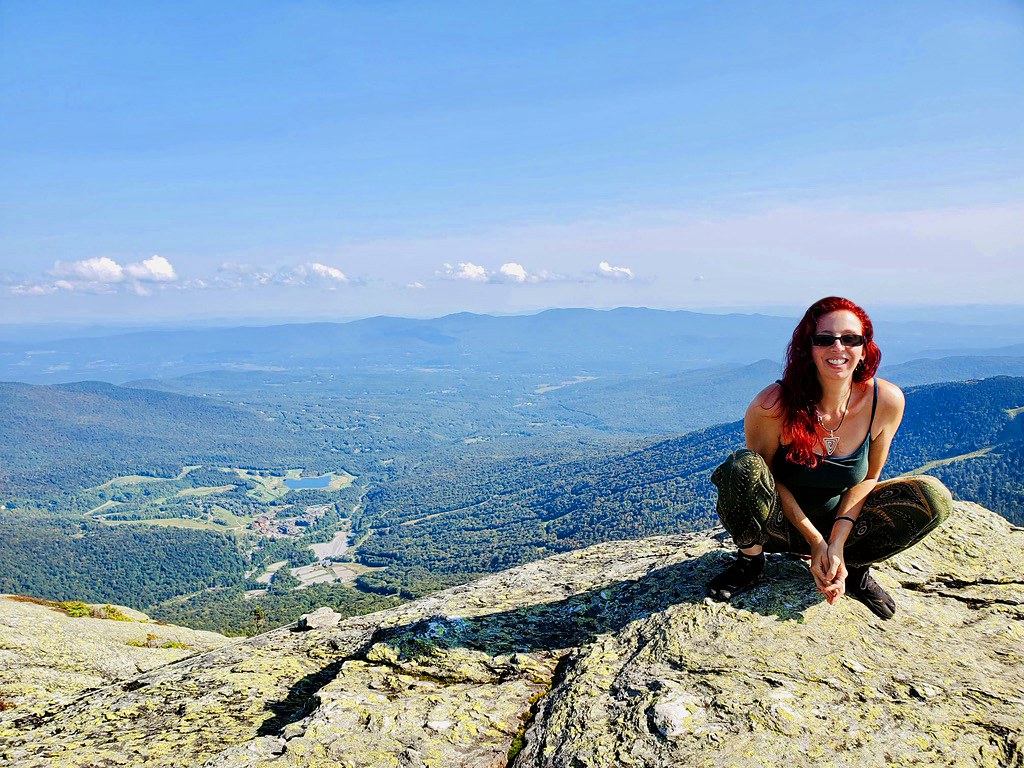
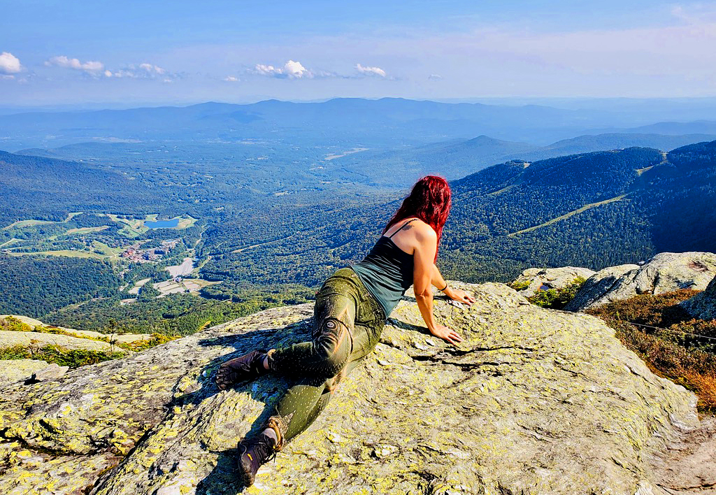
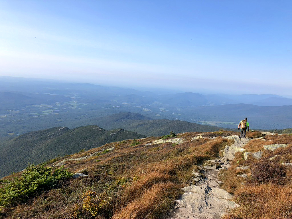
We walked along a ridge with spectacular views and then about an hour later…voila’ The real summit! There is no sign marking the spot, but there is a benchmark and one hell of a view! The best one of the trip! There was a guy dangling his feet off of the edge, journaling, there was a happy couple sitting high on a boulder, chatting, and a few others, snapping all the photos that don’t do any of it justice. I looked at Bryan and said, “THIS! This is why I climb mountains! We are at the highest point of the entire state of Vermont with the best view!” I just wanted to hang out there all day. As it was, we spent about an hour there. It was 5pm when we decided to start the decent.
My giddiness quickly turned into frozen terror very shortly after leaving the summit. There were 2 parts on the way down that made me say, “Oh hell no, I’m not doing that l!”. Bryan saw my terrified face and stepped up to encourage me through those sections. That took major finagling. I even had to watch several other people disappear over the sharp edge before I decided to attempt it myself. I really felt confident about every other mountain on the trip and I even loved the iron rung part on this mountain, but when I saw that very steep and sharp edge and knew I was supposed to scale down it….um…. I got vertigo pretty bad there. All you see is mountain edge and then nothing, but lots of space…air….death… if you make one wrong move. As I stood there, frozen, I imagined suddenly sprouting wings and flying safely down. That or calling a helicopter. Both were not actual options, so I had to do it. I absolutely love bouldering and climbing and using my entire body to scale up and down mountains, but the maximum exposure area really got me sweating. One basically does a very controlled butt slide down until you can reach another tiny foothold…then slide a bit more to the next and so on. It’s a good thing I’m tall! It did not seem possible. It was very vertical and had very little to hold onto. Whew…
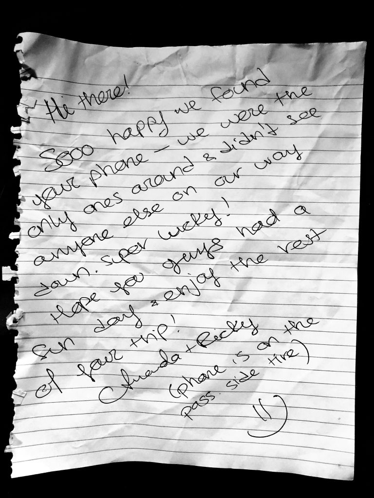
So, after making it past both death defying sections, I reached for my phone to take a photo and shiiiittttttttt I lost my phone! …Insert mini freak out… Oh my god, I cant go back up there to look for it! I panicked! I decided to call my phone in hopes that someone would hear it and answer. I was so happy when I heard a guys voice say, “Hello”. At first, I thought it was Bryan who started going to look for it. “Where is it?!?” , I screamed! The voice on the other end laughed and said that it was at the summit of Mount Mansfield. I suddenly realized that this was a total stranger. He said that they would find my green Kia in the parking lot and leave it on the wheel. I told him that we hiked up Hellbrook and was planning on hiking Hellbrook all the way back down, so it would be some time till we were back and to not wait for us. He was super shocked that we were taking Hellbrook down. Yeah, no shit.
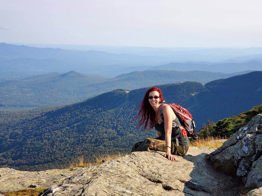
Other than the 2 back-to-back sweaty-dread-inducing sections, it was nothing super crazy after that. All still very steep, however, but by comparison, “easy”. By the time we got back to the car, it was 8:24pm. 11 hours later. With the dense tree cover, it got dark sooner than normal. We had a few hours of very slow downward climbing with a headlamp and flashlight only. It seemed to take forever to get off of that mountain. But, sure enough, my phone was there waiting for me on the tire when we got back with a nice note attached. I wish he would have left a number or some contact information, so I could thank him profusely again, but there was nothing.
I placed the note in my glove compartment for safe keeping and then searched immediately for food nearby. We were starving, so we went directly to a pizza place called, Piecasso in Stowe, VT. Bryan was so proud of what he just accomplished that when the hostess asked us, “Do you want to sit inside or outside” he said, “I don’t care we just got off of the mountain!” Haha! Not any specific mountain, just the mountain. She could have cared less, but it was cute. I’m glad that I could spread my love of mountain climbing to others!
Once full of food, I couldn’t wait to get to camp. We decided that because our bodies were sore, that the next day would be a rest day. Also, Before the trip, Bryan’s friend asked us to stop and pick him up some beer at The Alchemist Brewery. We would have been driving right past it, and wanted to find a campground close by so we could pick up beer quickly and be on our way. Unfortunately, the only thing we could find was Little River State Park in Waterburry, VT…39 minutes past it! Sigh…That didn’t work out so well. Zzz…
Thursday, Sept. 10th: I actually got some sleep! Ahhh! 2 things I desperately needed: Sleep and a shower! By 9:30AM, we were at The Vermont Artisan Coffee & Tea. My grumbling belly was hoping it would be a one stop shop with breakfast foods too, but unfortunately, it was strictly coffee and teas. So, I got a really yummy Chai and Bryan got coffee. We, then, plugged The Alchemist Brewery into GPS and went back the 39 minutes to get his friends beer. The lady told us that the beer sitting in the car for a couple of days would most certainly get skunked by the time we delivered it, but his friend wanted it anyways. So, that seemed so worth the backtracking…yeeeeah… Apparently, it’s good beer when it’s fresh.
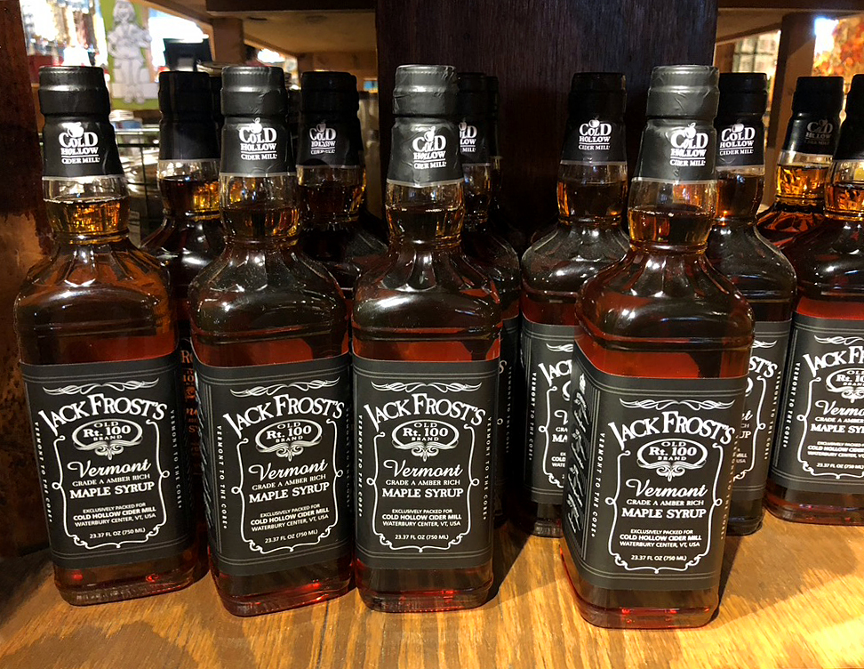
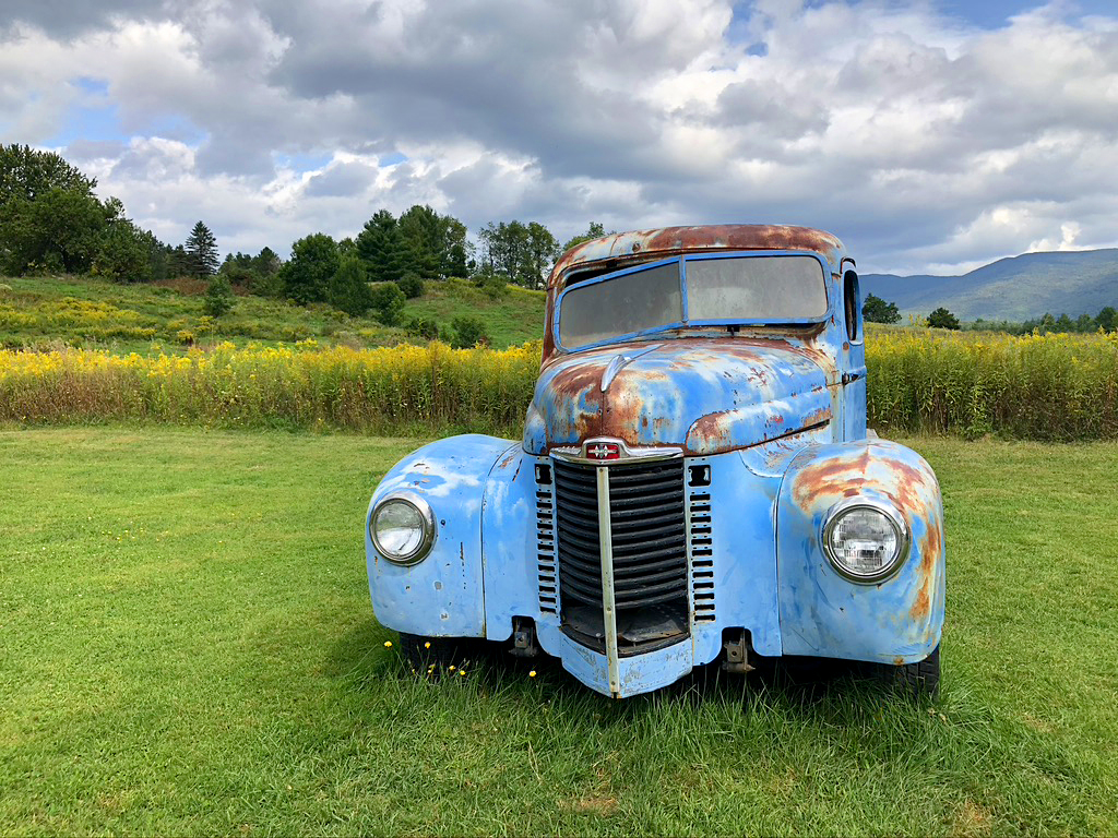
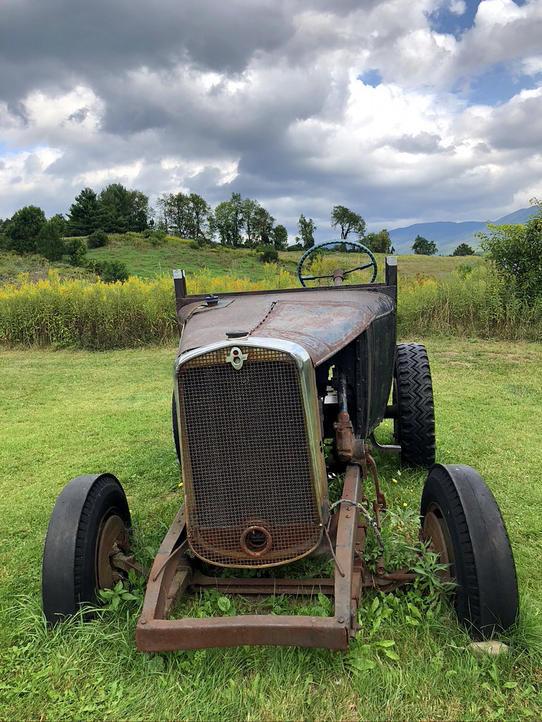
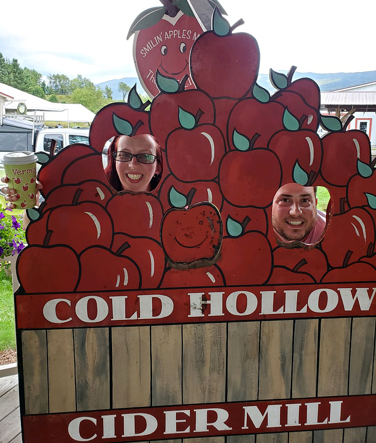
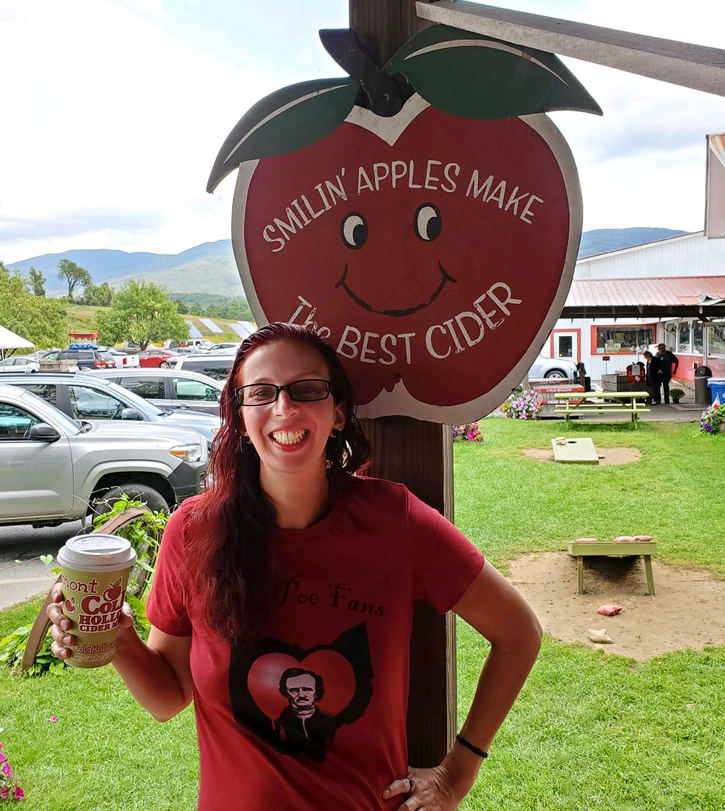
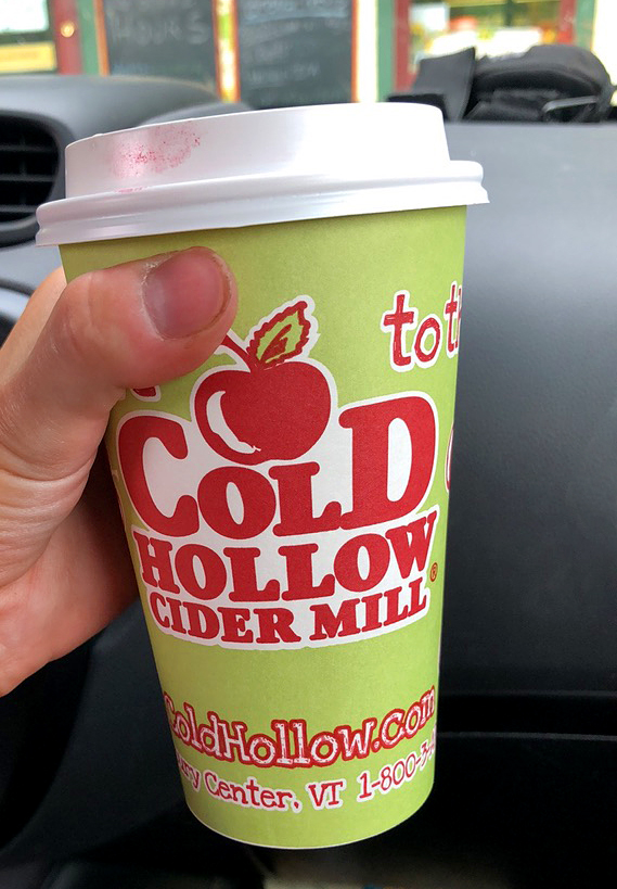
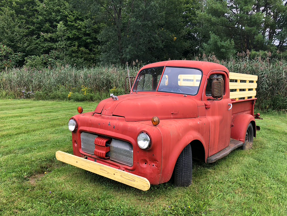
On the way back, I had to stop at Cold Hollow Cider Mill. It was only 15 minutes away from the Brewery. The first, and only other time, that I was in Vermont, I had the best Apple Cider and Apple Cider doughnut there. I wanted to go back since we were so close. MMM! I got a hot apple cider and got Bryan some hot sauce. We were still hungry and hadn’t eaten yet, but I was not feeling a sugary doughnut (even though they are amazing and you should go there!). Right outside, in a grassy field, their were a few old rusted cars and tracker that I had to photograph.
The last time I was in the area, my day consisted of a beer breakfast at The Merrimack, NH Budweiser Brewery tour (complete with the beautiful Clydesdales). Right after that, I did the Ben and Jerry’s tour and had brownie ice cream for lunch in Waterbury, VT, then had my apple cider doughnut dinner with hot cider at the cider mill. I highly recommend following my footsteps on all that.
Vermont is so beautiful and we nearly drove up through the entire state. I didn’t mind. That was our free day to mess around. After chilling at the Cold Hollow Cider Mill for a bit, we headed towards New York to find a camp ground outside of Mount Marcy, NY’s high peak. We were looking up places to camp and a place to eat along the route. We needed more than just car snacks.
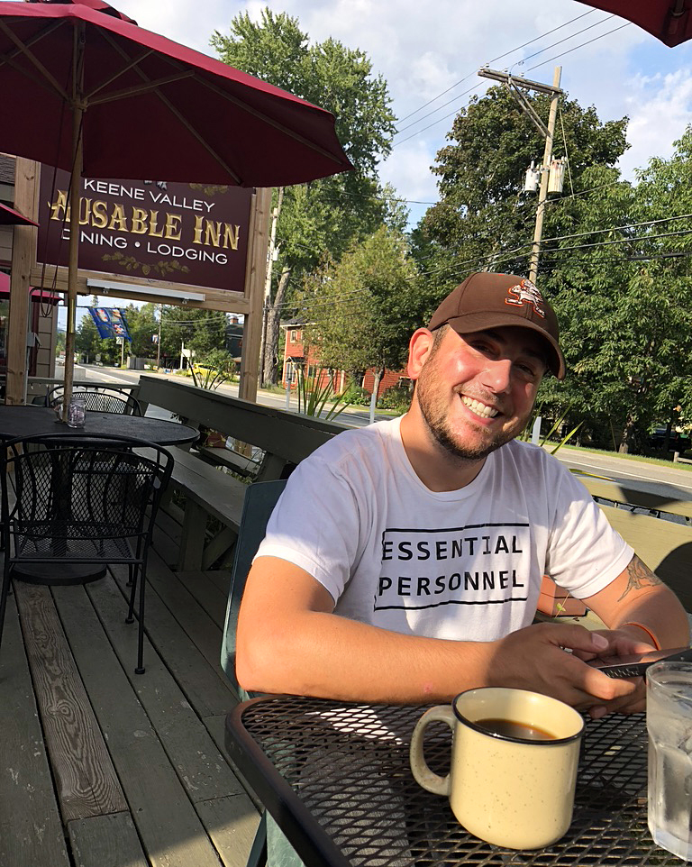
We drove about 2 hours and fifteen minutes and finally found a place called Ausable Inn Dining and Lodging. We ate our “breakfast” on the patio in the sun. It was a beautiful sunny day. We rolled in, starving, a little after 4. While there, eating, we found a place to stay for the night called, Adirondak Loj & Heart Lake Program Center only a half hour away.
They told me our camp site number over the phone and said that we could just set-up when we got there and pay the next day, if the office was closed by the time we got there. We ended up getting there before the office was closed and the sun was still up! We were excited that we would finally get to set up camp in the light! We we looking forward to having time to unwind together, instead of having to set-up in the pitch dark while exhausted and ready to crash. They were getting ready to close, so I just wanted to find the site number and commence relaxing. Bryan, however, wanted me to check-in and take care of it then because we were passing right by the office. So, I walked up the the desk and I’m filling out the paperwork as he asked to see my lisence. I handed it to him and he immediately said that I’m from Ohio and Ohio was just added to the list of states that needed to be quarantined if coming into NY! What!? I knew about this list and had been checking it while we had been bouncing back and forth between states, and Ohio was not on it. He said that Ohio was just added and we couldn’t stay there and we were not supposed to be in the state. Um…
So, I go back to the car and tell Bryan the bad news. All of our plans for a restful evening came crashing down. I instantly started looking for something else in the surrounding states, which would have meant going back to Vermont or Canada at that point (no passports on us). We were getting discouraged and even thought about just heading all the way back home. But we only had one more mountain to conquer and we really wanted to try to make that happen. I kept calling places. I knew that we were running out of time because campgrounds would be closing soon, if not already closed. From our position in Adirondack Park, options were very limited. I made the decision to call other campgrounds in the area in hopes of finding a place that would let us stay just for one night. At that point our choices were, sleep in the car somewhere, go back to Ohio, or find another campground in NY…where we were apparently not allowed to be.
I ended up finding a place that was 36 minutes away in the other direction, but it sounded like they would let us stay there. The office at North Pole Campground in Wilmington, NY stays open all night. Perfect! We get there close to 7:30 and I walk in hoping for the best. All is going well and then she asks to see my license. Shit! I show it to her and then, she tells me the same thing, that Ohio was added that day to the Quarantine list. I tell her that we have been in NY traveling around since before Ohio was added to the list…practically begging her to let us stay for the night. She said, “Oh! Well, in that case, just show me a receipt that shows that were in NY prior to them adding Ohio to the list of states that had to be quarantined coming to NY!”
“What!? Shit, I wish the other campsite would have mentioned that!”
So, I go digging in my wallet. I know I’m not the best at keeping receipts, but I found one! Only one! And it’s from NY!!!! I show it to her and cringe and wait for her to tell me bad news, but she says quickly…”OK, that’s all I need to see!”
SIGH…I lucked out big time!
Seeing how the sun set shortly after 7pm, and it was 7:30, it was going to be another very dark set-up, indeed. We were just happy that we had a place to sleep and a chance to climb our last planned mountain of the trip…The highest one of the trip! 15 miles total! All the other ones were building us up to this moment.
18 minutes away from Marcy…
Friday, Sept. 11th: My first thought upon waking up (for the last time) was,
“I am literally freezing to death!” …followed by
…“There is no way I can do Mount Marcy like this!”
The frigid temperatures near the lake during the night killed my sleep. I didn’t have windows open, I had blankets wrapped around me, but it didn’t matter. I didn’t sleep and I was exhausted. I shivered the entire night. It was in the 30’s and just rough. However, before retiring to my hammock, I joined Bryan in his tent for some Uno and wine. It was the first night that I got to actually hang out in the tent with him before crashing. Normally, we would just roll in late, set-up and he would leave me in my hammock after sharing a night cap in my car. But this last night, we had a little bit of chill time after getting all set-up. We had fun playing Uno (that I always have in my purse) and the wine was helping with the cold. We made it fun! The campground was at a beautiful place called North Pole Resorts. I can say that I’ve been to 2 North Poles now: North Pole, AK and North Pole, NY, but neither one is the real North Pole. The real one is definitely on my list! North Pole, NY is a small hamlet in the town of Wilmington in the Adirondack Mountains.
Once, I talked myself out of my hammock and into the even colder outdoors, I told Bryan that I just couldn’t do Marcy feeling the way I was… still on my period and on very little sleep. As I was up and moving, that decision was solidified by how sore my body was. Bryan was no better off. It was a no brainer…Marcy had to wait for another trip. He agreed without any hesitation whatsoever. I wanted to see if I would change my mind after showering, but I did not. Speaking of the shower, I’ve camped at lots of places in lots of different states, and this was the first time we had either experienced coin showers at a campsite. It didn’t say how many minutes you would get either, so I had no idea how fast I had to rush. Bryan had the same thought. Turns out that we both had a little extra time to stand there and enjoy the very hot water before it shut off. Ahhh…
We had planned to visit a friend outside of Rochester after Marcy because we would pass right by where she was visiting from LA. So, I messaged her right away and told her of our quick change of plans and that we would be en route to see her right away instead of after Marcy. But, first, we needed to find food.
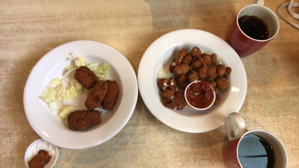
A half hour later, by 1 o’clock, we were gorging on the best schizophrenic breakfast / lunch EVER at Noon Mark Diner (Ironically enough this place was only a minute away from the place we ate ate the night before)! Spicy cheese curds, jalapeño poppers, French toast, eggs with cheese and an English muffin with cream cheese. We split the curds and poppers, but the rest was alll mine. Bryan had his own separate noms too. Even though we weren’t climbing Marcy, I was still starving from all the calories burned up the previous days. We ate nearly every single bite!
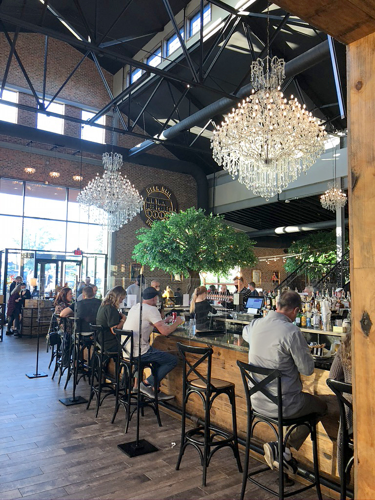
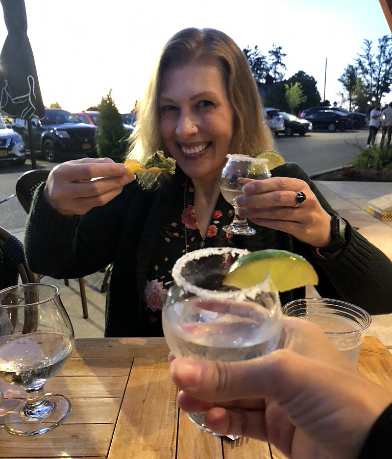
ETA: About 5 hours till I was going to meet Lisa Lichtenfels-Ehrnman, a friend that I had never seen in person, yet! We were meeting her and her friend, Fred that she was staying with, at New York Beer Project in South Lockport. They were nice to pick a place that was on our route home. Our only stop was to fuel up and pee in Elbridge along the way.
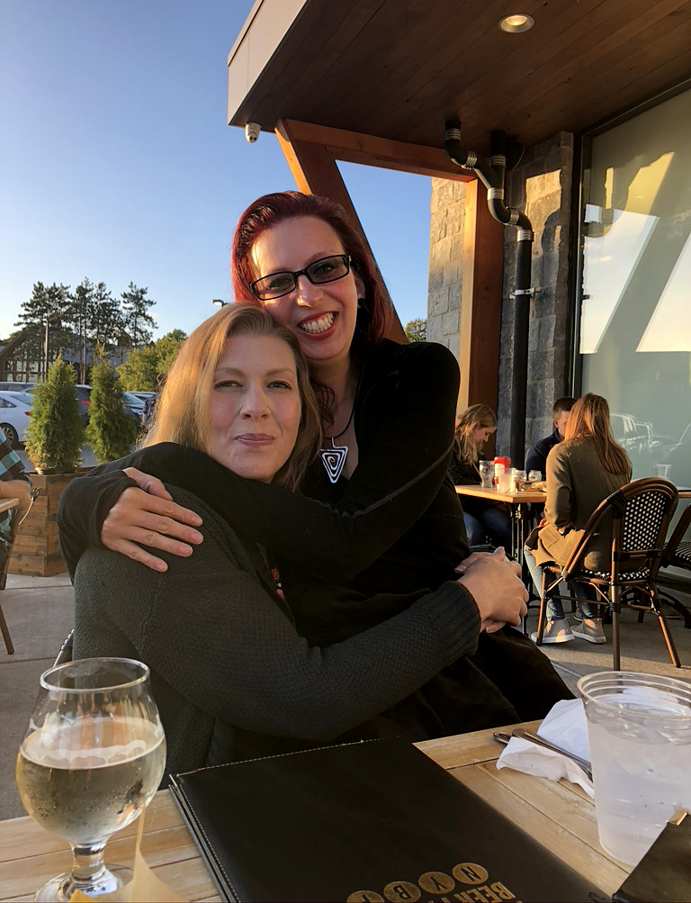
We got to the restaurant at a perfect time. It was close to 7, dinner time. We were hungry again and I had to pee like crazy too! Fred and Lisa were waiting for us on the patio of this huge beautiful place. There were lots of hugs, tons of fun converstaion, some dancing, Lisa’s first shots of Tequila, and great food! What a great, but sleepy Friday night. I wanted to hang out all night, but Bryan and I were beat.
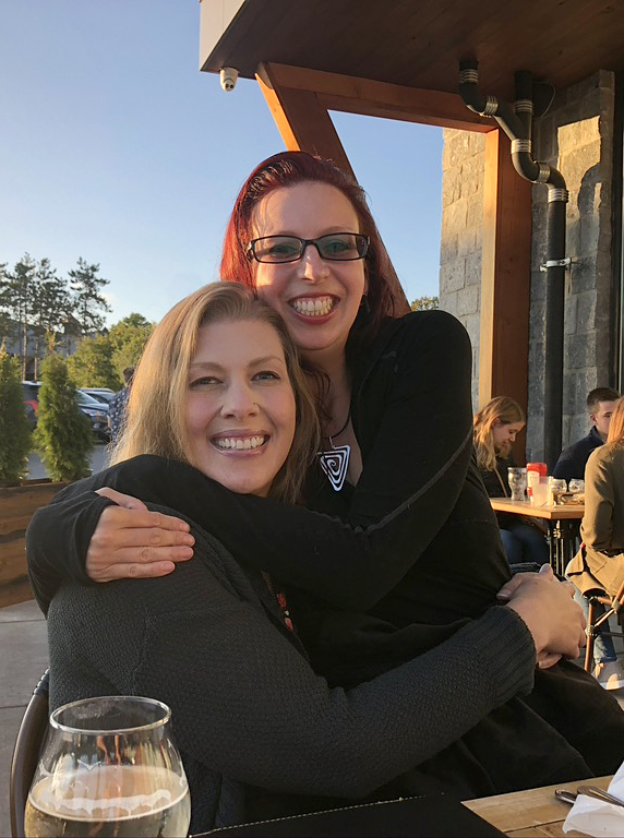
We left the restaurant around 9, but since they were parked close to my car, Lisa joined us in the warmth to chat a bit longer and say our, “Goodbyes”. Fred was tired and decided to wait for her in his car; laughing as us from afar. We were having too much fun, however we knew we still had 5 hours on the road, in the dead of the night, until I could squeeze my kitty, Gingi again…
Saturday, Sept. 12th: We pulled into Bryan’s driveway around 3am. He told me that I fell asleep for a bit while he drove us home, but I was still so sleepy. He unpacked all of his stuff and I took over from there and got my tired butt home safely. It felt really strange to pull away without him since we had been together, every minute, for a week. We were sad that we didn’t get to do Mount Marcy, so we were already planning on coming back for a weekend trip to get that one in…someday.
1,896 miles, 7 days, 6 states, 5 state high peaks, 2 gravesites of American writers, and one person wishing she were still on the road…
